A Taste of the Larapinta Trail
The backdrop
Travel is fatal to prejudice, bigotry, and narrow-mindedness (Mark Twain).
I was reminded of this sentiment as I walked sections of the Larapinta Trail recently.
It was a six day guided trip and, as our group of 16 plus two guides snaked away from the trailhead at the historic Alice Springs Telegraph Station, the various prejudices I’d harboured against the trek wafted through my mind.
Over the years, my walking inclination and appetite has skewed strongly towards lush landscapes over harsh; green over brown; streams over dry river-beds; temperate climates over hot; leaf-strewn trails over rock. And the fewer flies, the better. Unsurprisingly then, despite my wish to walk most of Australia’s iconic multi-day walks, the Larapinta Trail hadn’t pushed its way to the forefront of my plans.
I’ve also walked mainly independently or self-guided (with walk operator assistance). My rational self comprehends the benefits of guides but a stubborn, individualistic nature stands in the way.
A major reason I’m on this trip is that three of my friends - Ian, Neri and Chris - together with my wife Cathy had suggested we do it and life doesn’t throw up too many opportunities to do multi-day walks with friends.
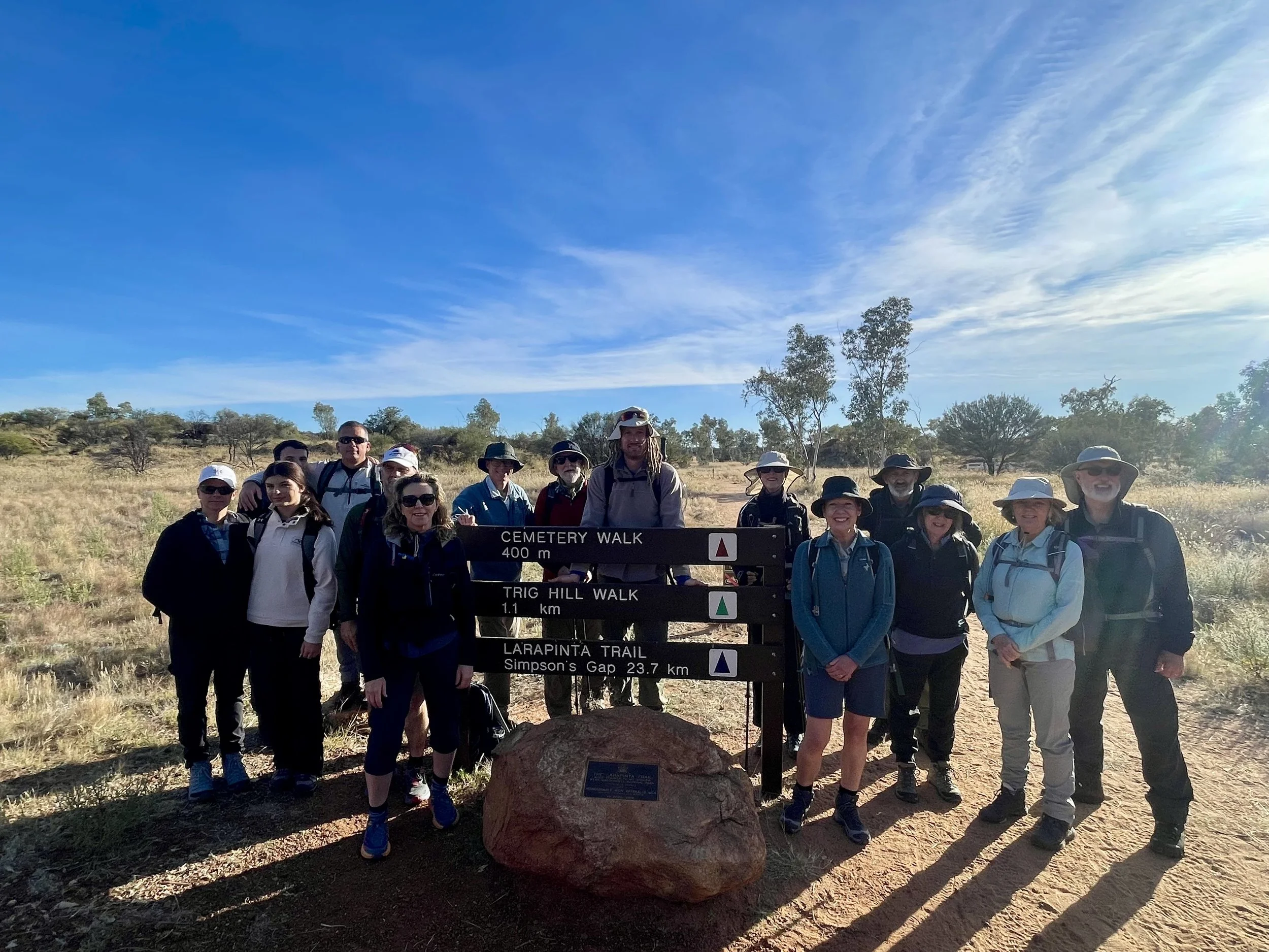
Trailhead of the Larapinta

Day 1
Today’s 16km stretch took us from the Telegraph Station to Wallaby Gap. The landscape is fairly nondescript for the first couple of hours, although the novel flora provides interest. The temperature creeps up into the mid-20’s and the flies are pesky. At lunch there’s little shade. As alway at the start of a walk, I’m upbeat … but my hesitations niggle away.
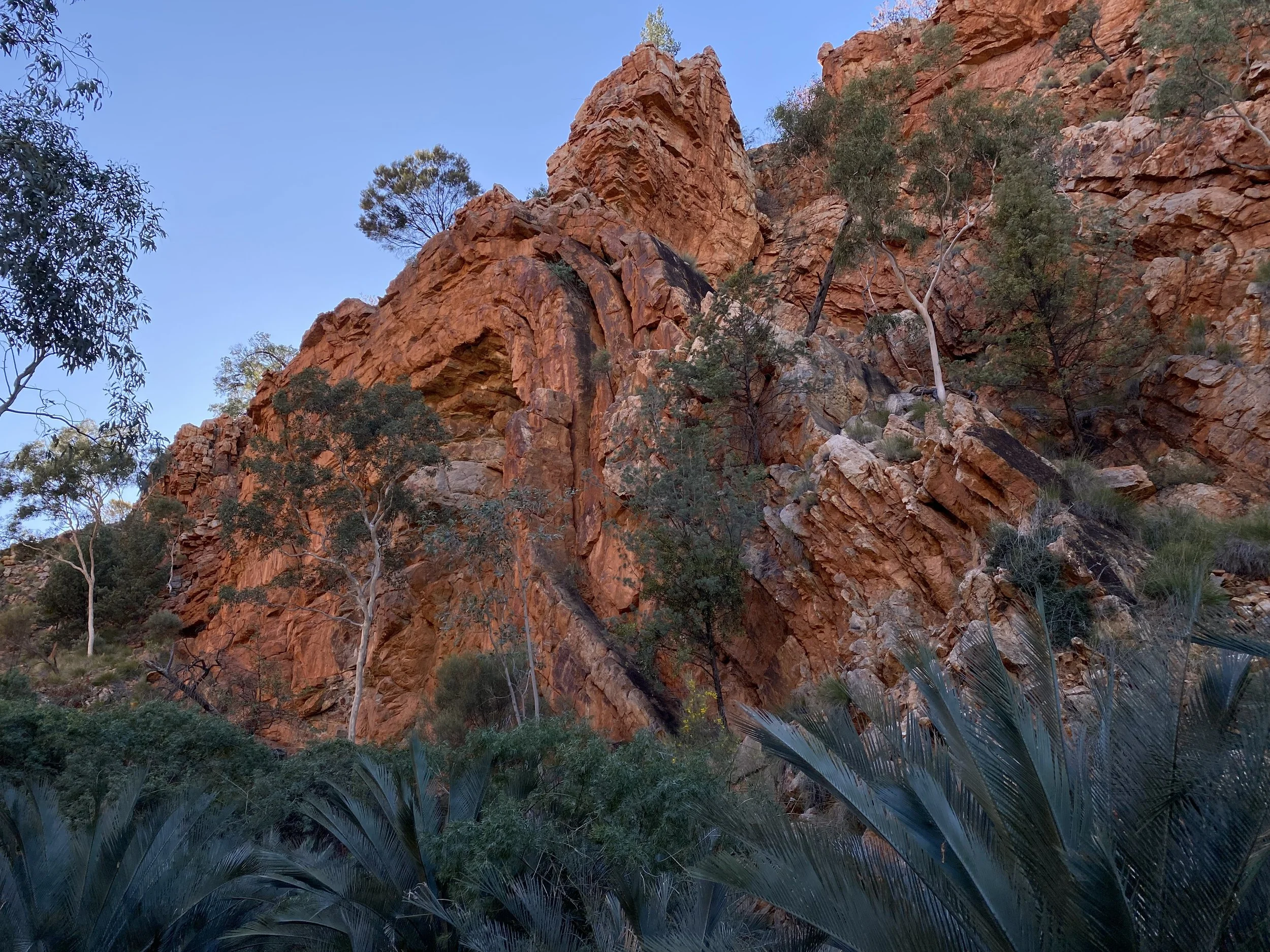
Mid-afternoon, we ascend one of the first features of the West MacDonnell Ranges - the Euro Ridge. It’s named after a species of wallaby, and from afar the ridge does look like two small wallabies peering down into a valley.
From Euro Ridge we get views in all directions. To the east, nestled amongst hills and ridges, lies Alice Springs. To the west, the West MacDonnells stretch as far as the eye can see. To the south and north, the endless plains of the Never Never shimmer in the afternoon heat. I start taking a few photos.
That night at our campsite near Wallaby Gap we meet Rayleen Brown, an indigenous woman who is an enthusiastic and articulate advocate for bush foods from Central Australia. For a couple hours she captivates us with her descriptions of the edible plants and animals in our midst. She talks about her dream of producing bush foods in commercial quantities - and the challenges of doing so. We sample various of her products; the flavours are fresh and vibrant. Our group demolish the offerings, and pepper Rayleen with questions.
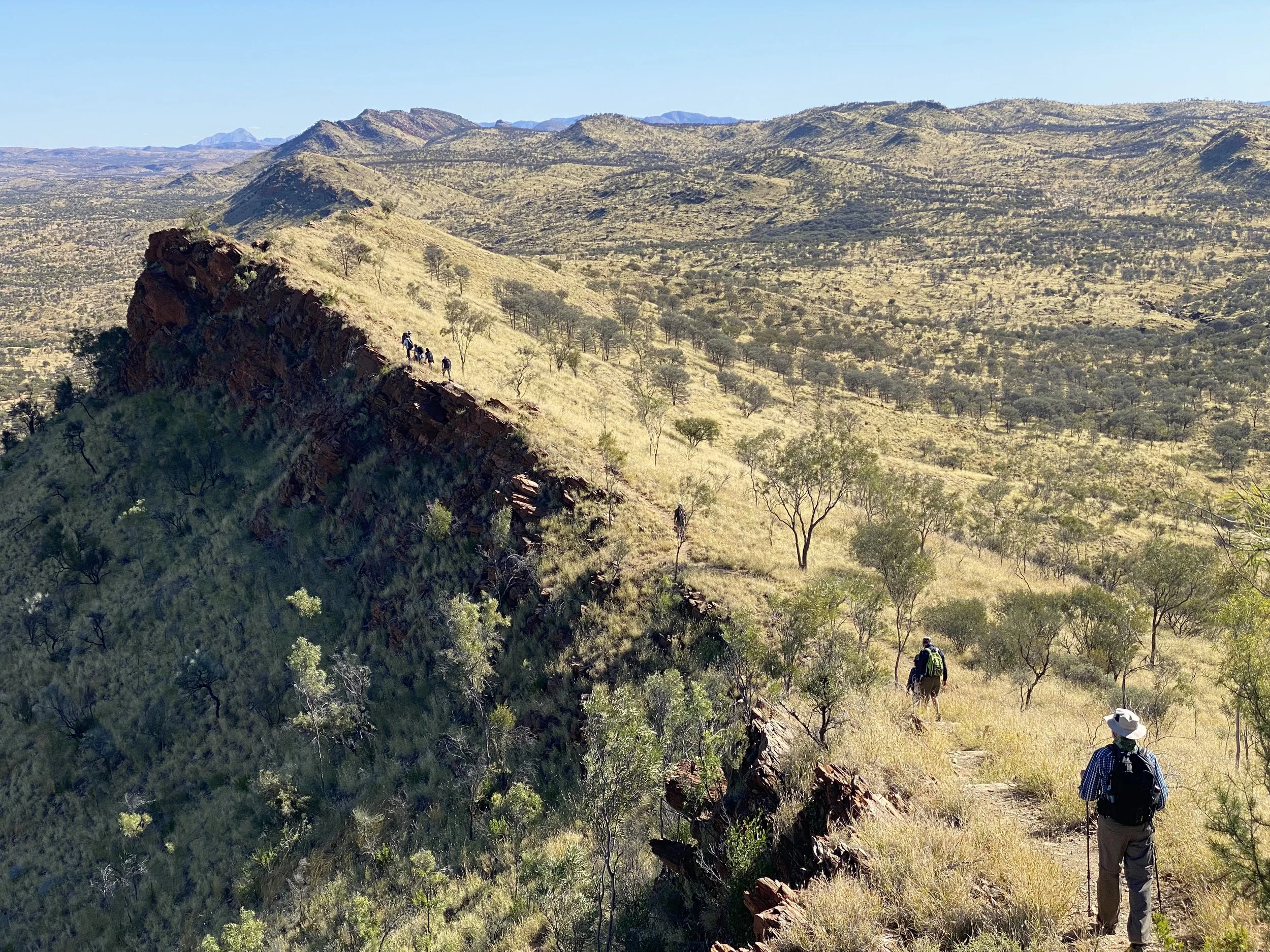
Looking westwards from Euro Ridge
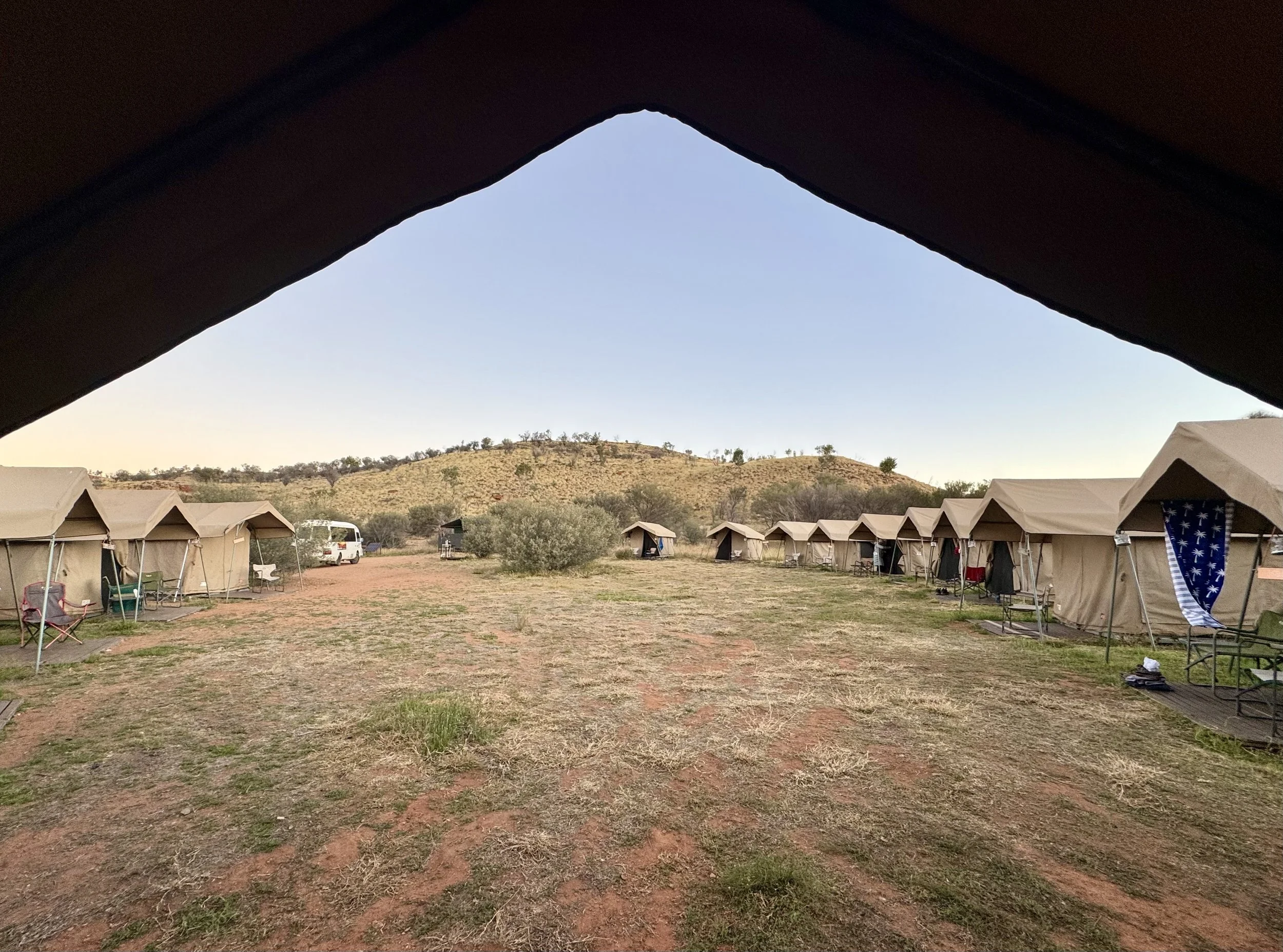
Campsite near Wallaby Gap
Day 2
We walk to Simpsons Gap directly from our campsite this morning. As we leave at 8am, the temperature is 4 or 5. That first couple of hours is idyllic - still, crisp air; soft light; abundant wildflowers and no flies.
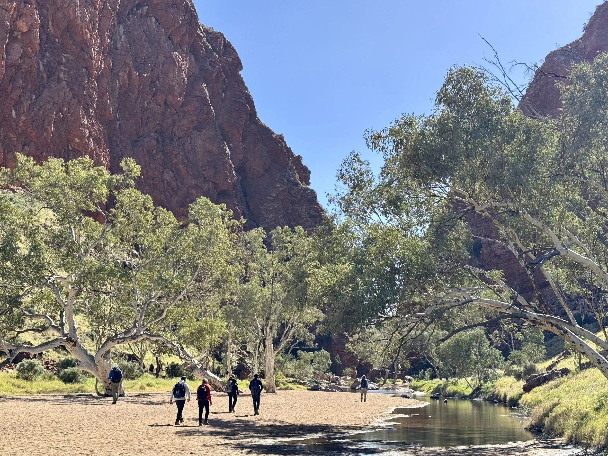
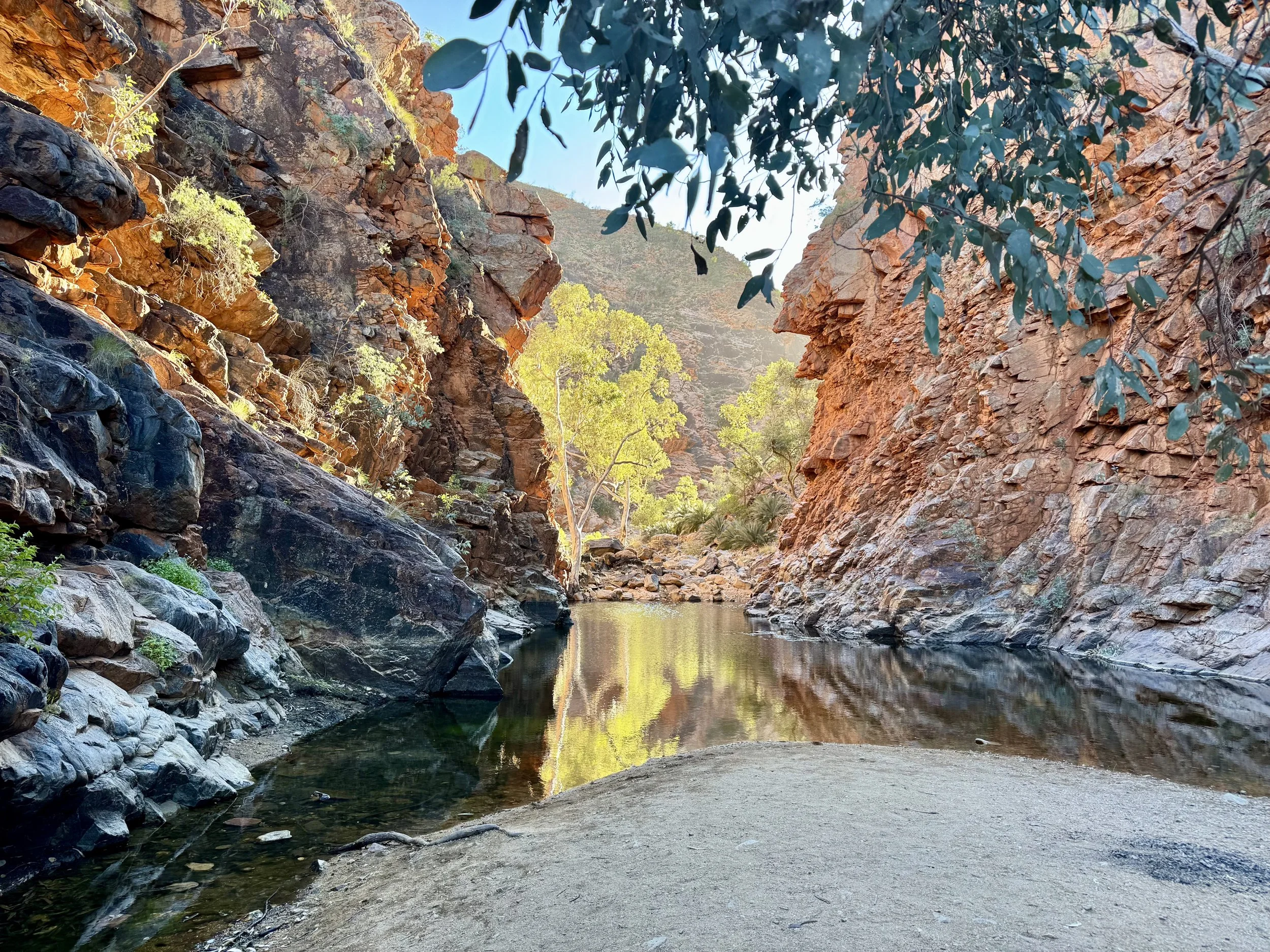
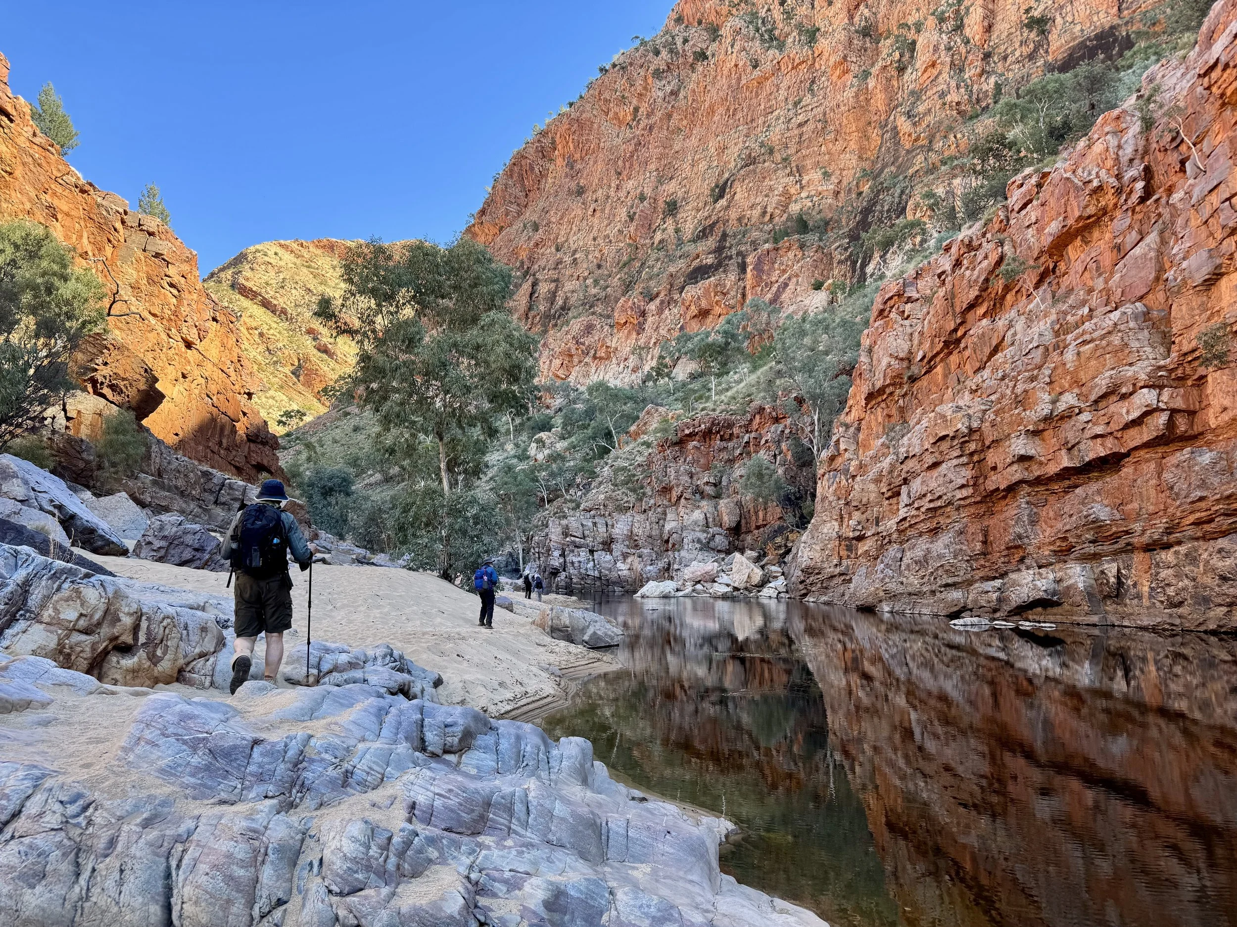
Simpsons Gap is the first of the well-known spectacular fissures in the West Macs. Rugged, iron-oxide stained rock walls soar on either side of a small waterhole. It’s quite close to Alice Springs but still feels like a refuge and a place demanding respect and even reverence. You can sense why it’s long been an important spiritual site for the Arrernte people.
From Simpson’s Gap, we drive to Standley Chasm. Here we’re provided with a presentation on skin names by William, an Arrernte man. Most of us are staggered by the sophistication of the traditional extended family structure. Its role in creating kinship through indigenous communities is a revelation.
Camp tonight is near Serpentine Chalet Dam. Our energetic guides - Anthony, Kayla and Blaise - cook barramundi on the BBQ. It’s followed by chocolate pudding baked in the coals of the campfire. Our group - with ages ranging from 17 to 70 - has bonded and the conversation flows easily.
Tonight one of the guides gently reprimands me for putting a log on the campfire. I’ve probably lit and supervised more campfires than that guide has had hot dinners, but I silently remind myself that guided trips necessarily carry rules. While there are many benefits of guided trips, the more pedantic rules are a downside.
Approaching Simpsons Gap
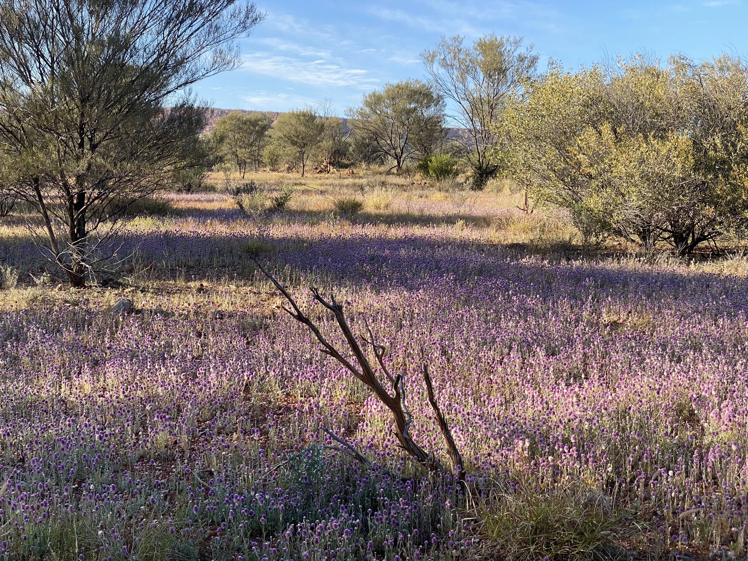
Wildflowers near Simpsons Gap
Day 3
Today is one of the longer walking days. During Anthony’s briefing he mentions an incline. Ian, a born wordsmith, picks up on this, noting that “incline” is a very generic term and covers the slightest of gradients to roped-up cliff climbing. Anthony ponders this and then diplomatically assures Ian that it’s a moderate incline only.
A short transfer takes us to our start near Serpentine Gorge. Again, this gorge and its waterhole convey peace and spirituality. At 8am it’s as quiet as a cathedral and Blaise suggests we visit in silence. We sit contentedly for a while and watch as the sun lights up a few classic ghost gums at the head of the gorge.
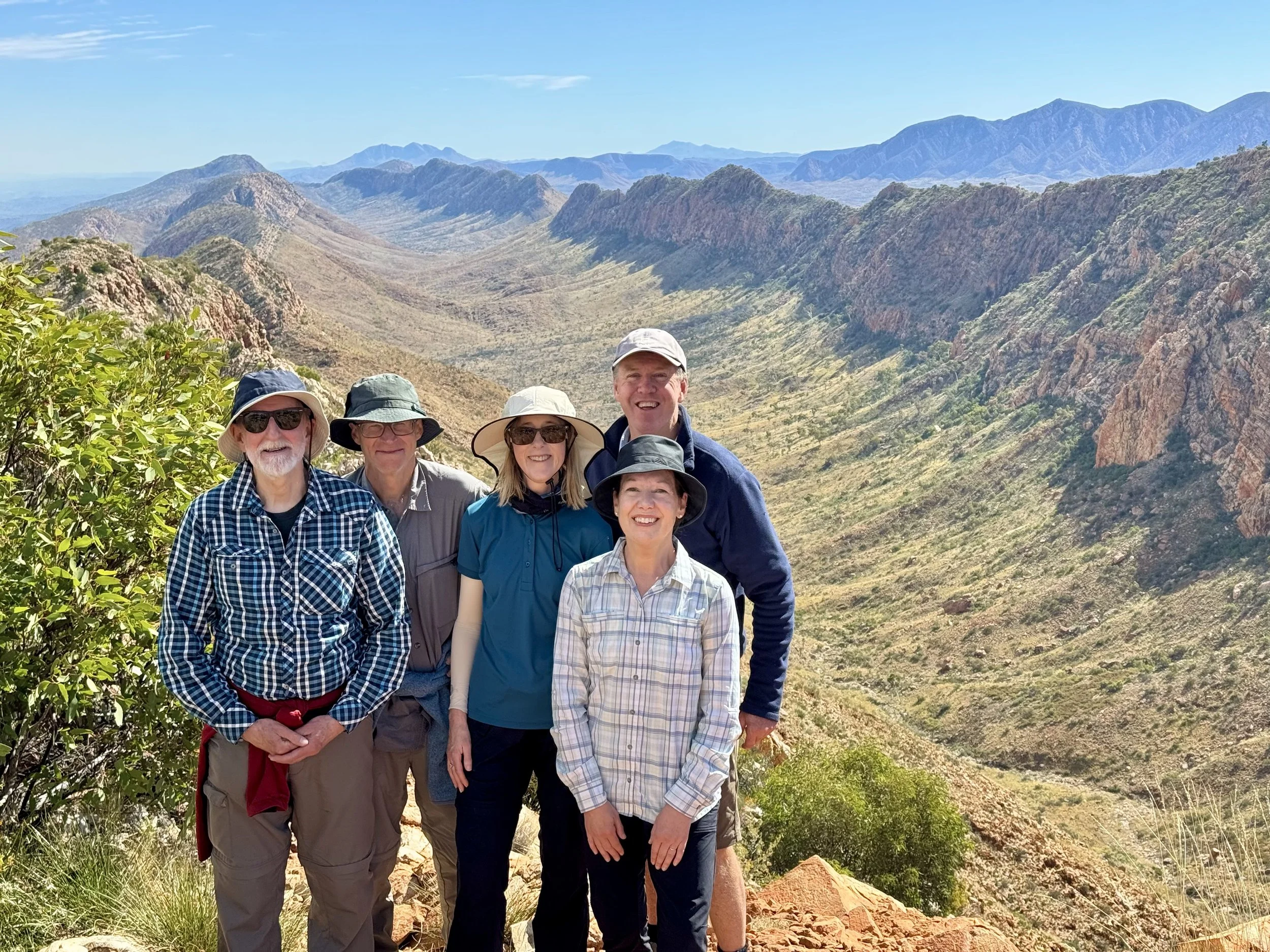
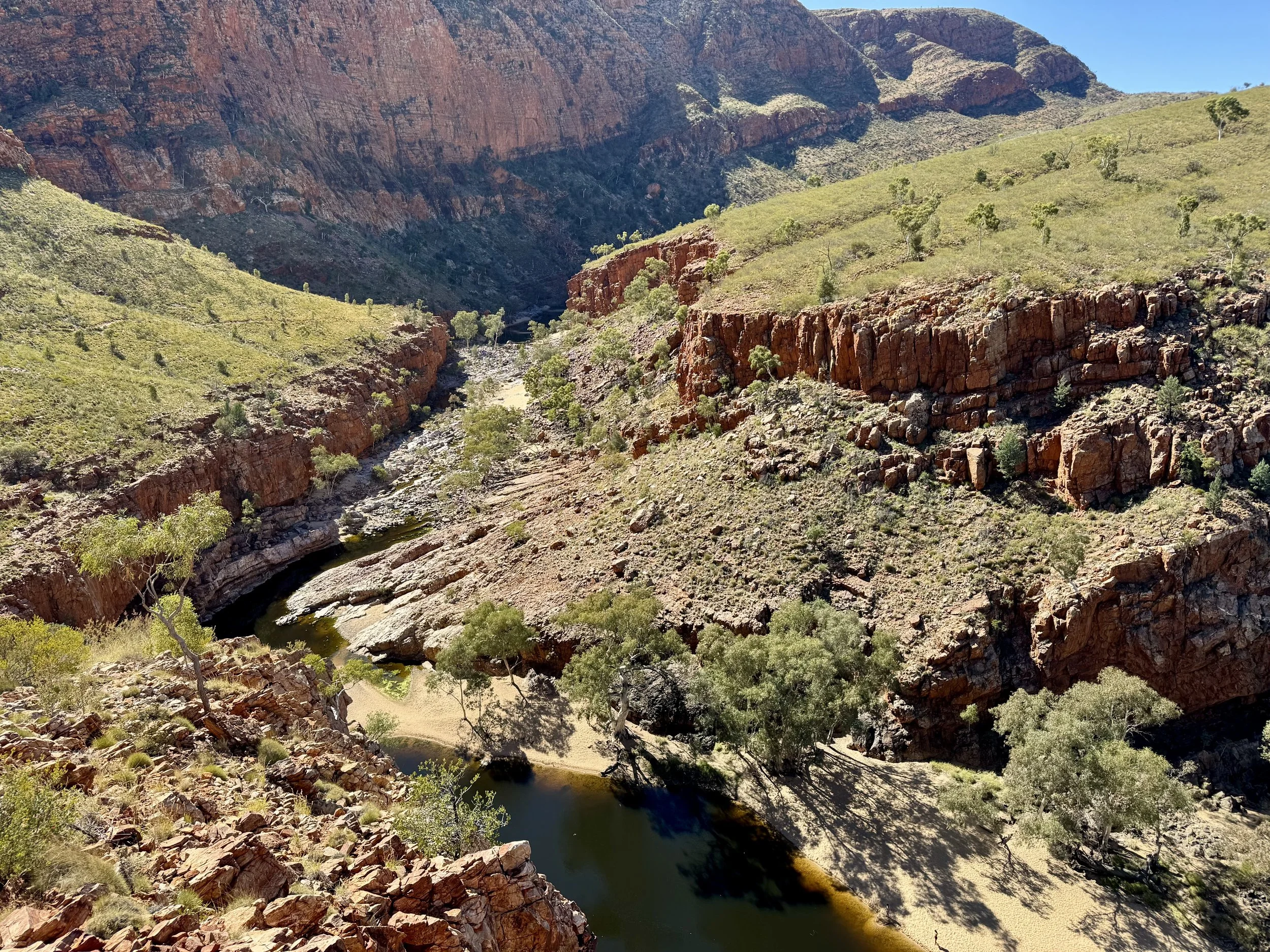
From Serpentine Gorge, we tackle Anthony’s “moderate incline” ascent which takes us to a wide ridge that, in turn, leads to Counts Point. The ridge line provides the best walking so far. Panoramic views are almost constant and the vegetation is profuse and diverse. Counts Point provides vistas to the end of the Larapinta at Mt Sonder, and then further on to Mt Ziel (1,531m), Northern Territory’s highest peak.
Our walk today is cleverly designed to take us all the way back into our campsite of the previous night, near Serpentine Chalet Dam. Walking west into the late afternoon sun is hot going and leaves some pinkish faces. But the temperature drops quickly as the sun disappears. My open-air, bucket shower this evening is bracing - the water is warm but once the trickle finishes, you need to move quickly.
Serpentine Gorge
View from Counts Point
Day 4
Last night was the coldest night yet, with the temperature falling below zero. During the night, though tucked away in my sleeping bag and swag, I resorted to thermals and a beanie. Our morning porridge and coffee are very welcome. Similar to Day 2, we walk directly out of our campsite this morning. Gloves and beanies are still on as we head off at 8am.
We reach Inarlanga Pass after a couple of hours. We’re a fair way from Alice now so we have the narrow pass to ourselves. Large cycad palms - hundreds of years old - cluster here in the cooler micro-climate. They evidence the very different vegetation and landscape that existed here millions of years ago.
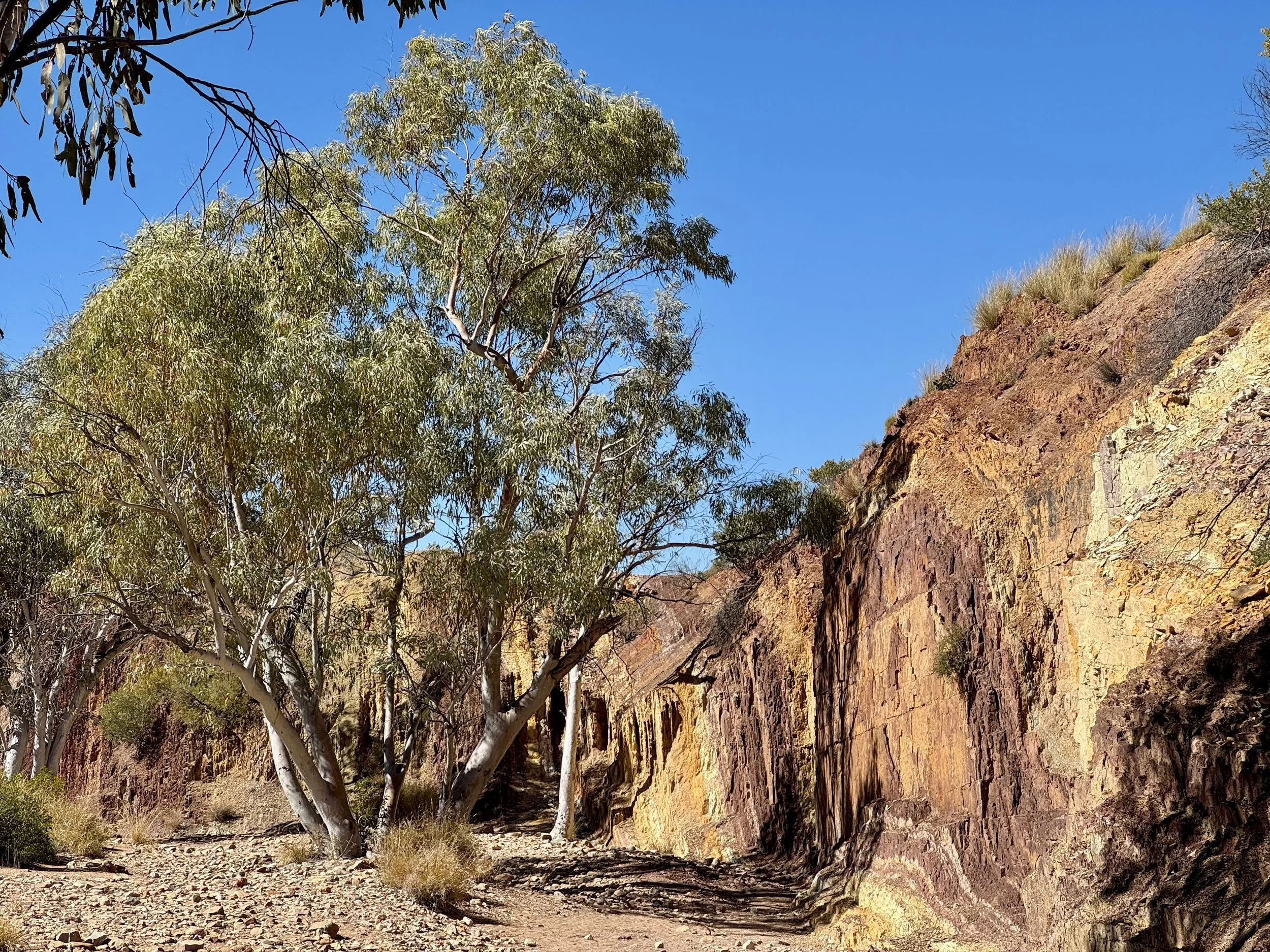
From Inarlanga Pass, we take a side track to the Ochre Pits, which are effectively a quarry for coloured minerals that were highly valued by indigenous peoples. Anthony explains how ochre was a traded commodity and so these productive pits were of significant value.
A swim at Glen Helen Gorge is on today’s agenda. Kayla and Blaise bravely set the example but, even though it’s a warm day, the water is far too cold for most of us.
We move to our third and final campsite late afternoon. It’s in a very remote spot in the southern shadow of Mt Sonder. All the chatter at camp is of the adventure tomorrow morning - the plan is to climb Mt Sonder in time to see the sunrise.
Vegetable curry and mini pavlovas tonight. Anthony, Kayla and Blaise continue to prove themselves dab hands in the camp kitchen. Everyone retires early, but the on-going sounds of tent zips suggest people are not getting much sleep.
Ochre Pits
Cycads at Inarlanga Pass
Day 5
We’re up before 2am and gone by 2.15am. Fourteen of our group of sixteen are in the bus. We start walking at 3am with all head torches in operation. There’s a full moon but the path is quite rocky, and there’s some scrambling, so artificial light is the prudent course.
Kayla sets a smart pace. There’s an art to guiding to sunrise on Mt Sonder. Obviously, you want to get your group up in time, but equally you don’t want to get up there too early as your group could get very cold waiting for sunrise at the chilly summit.
Our group stays close together, as instructed. There’s only ever about 50 metres between Kayla’s white light at the front of our pack and Anthony’s red light at the back. Chris is towards the back but his jovial singing drifts across the group. He tries to get a singalong going but for others there’s too much concentration on that spotlit two metres ahead of them.
Kayla has paced us well and we arrive at the summit at 6.50am. Sunrise is at 7.20 but for the 30 minutes prior to that the pre-dawn light is magical. There are more walkers at the summit than I expected - maybe 40 or so. But they spread out and it doesn’t seem over-crowded. Sunrise bathes the surrounding ridges, valleys and plains in warm golden light. Mt Sonder itself casts a long shadow that extends to the horizon. It’s an uplifting experience.
Back at camp we chill out for the afternoon. The flies do their best to disturb our summitting high, but most of us devise some means of escaping them.
Our last evening meal is roast lamb with all the trappings. We’ve come to expect camp kitchen delights from our guides-cum-chefs and they deliver again. It being the last night (and another cold one) I surreptitiously slip an extra log on the fire.
Tonight the moon rises late which means, ahead of that, the night sky is very clear. The Milky Way shimmers in a vast arc across the sky. Satellites whiz overhead; out here they feel incongruous.
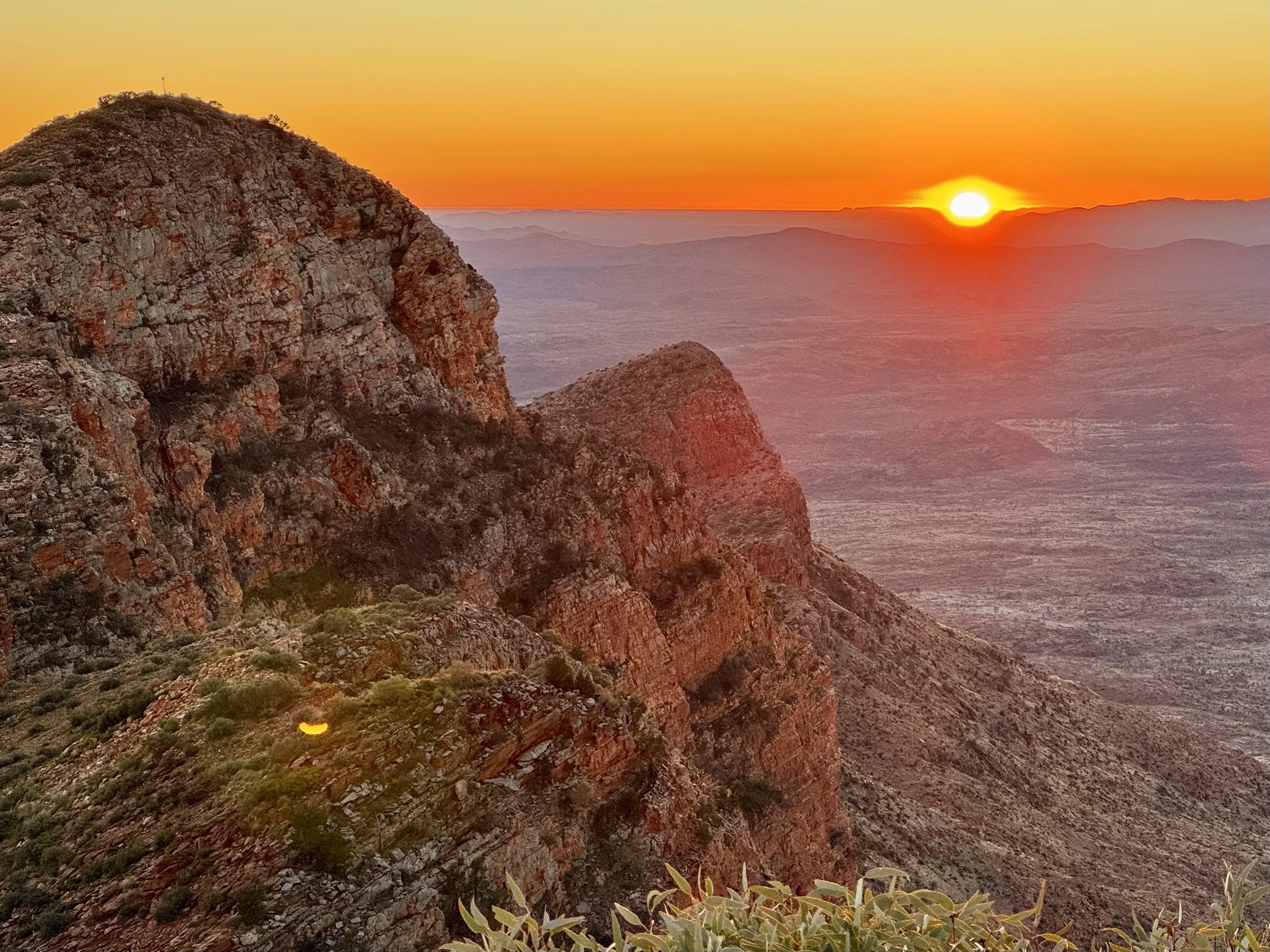
Sunrise atop Mt Sonder
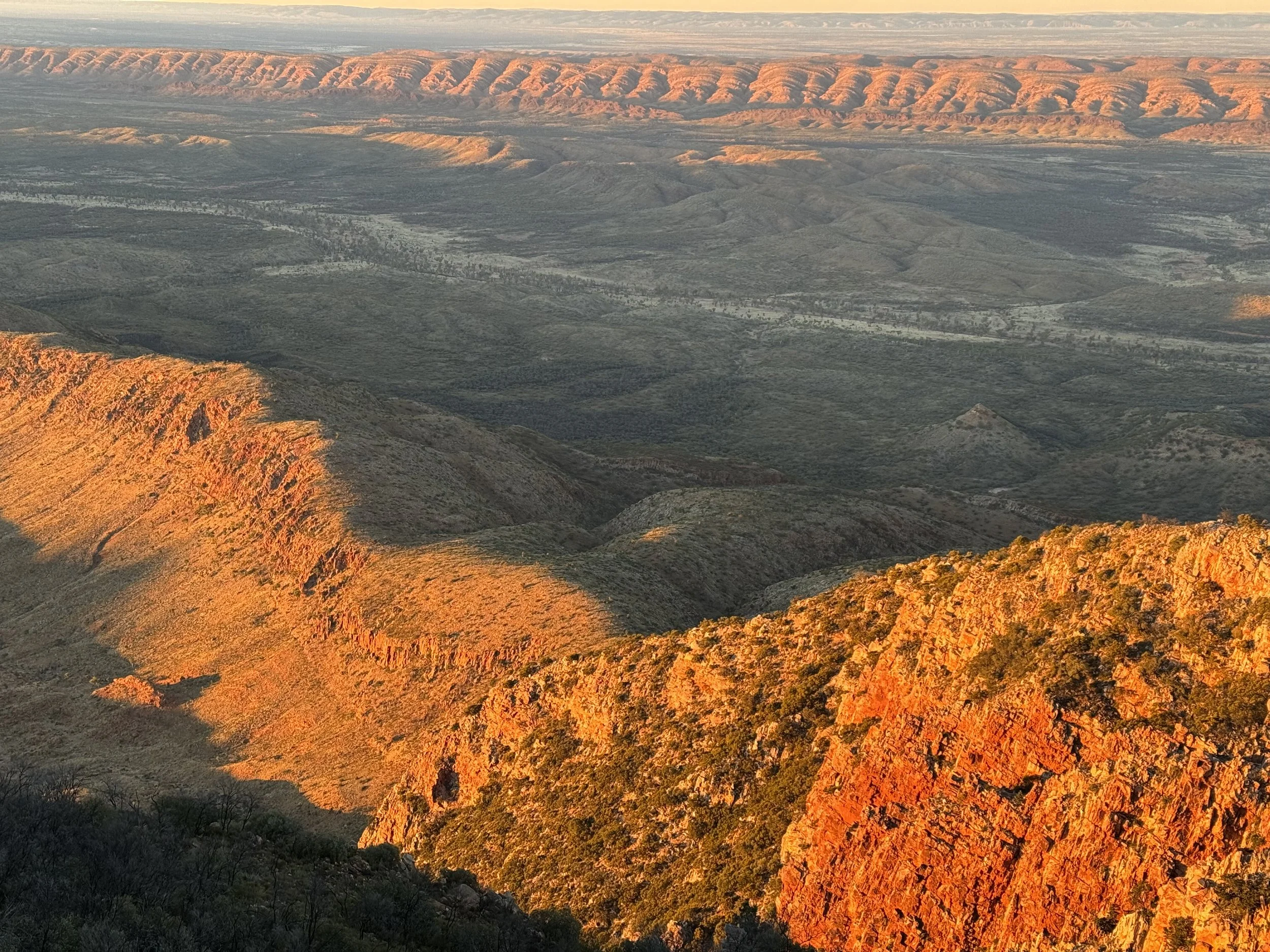
South-east from Mt Sonder
Day 6
After yesterday’s excitement, there’s a risk that today is anti-climactic. Perhaps with that in mind our final walk is the Ormiston Pound circuit walk that starts at Ormiston Pound. This is a marvellous walk with a bit of all of the walking delights of the West Macs.
Once we arrive at the upper reaches of the gorge itself, the track disappears and we pick our way through purple, grey and red boulders. Permanent waterholes are strewn along the base and the route requires that we wade through one of them. The last stage of the loop walk involves a final moderate incline to a lookout offering stunning aerial views of the gorge.
Ormiston Gorge
Ormiston Gorge Lookout
The Sum-up
Whilst my most favoured walking destinations will probably remain softer under foot and greener and damper than the Larapinta can offer, I totally understand the attraction of this iconic walk and loved doing it. In fact, I’d say that to walk along one of the Larapinta’s remote, high ridges overlooking surrounding ranges and plains and then to descend into the shaded sanctuary of a tucked away gorge is a quintessential Australian experience not to be missed.
Also, even a small taste of the harsh environment of the West MacDonnells, provides us with a deeper sense of the extraordinary skills, knowledge and culture that enabled indigenous peoples to flourish here for thousands of years.
Our guides were excellent. The energy, enthusiasm and knowledge they brought to the trip was truly impressive. I had expected at least one of them to have more years of experience guiding in Central Australia but there was enough between them and they had certainly done their homework.
And I do think the Larapinta Trail is one of those walks where a guided offering adds significantly to the overall experience. Yes, it’s less of a physical challenge but hearing from Rayleen about bush foods and William on family and kinship in indigenous nations was a highlight. Our guides, too, brought to life the flora, fauna and culture of the region in a way that would be more difficult for the independent traveller.
Thanks to our guides and my fellow 15 walkers: the Sunshine Coast 5, the Louisiana 4, the Ballarat 2 and the Melbourne 4.
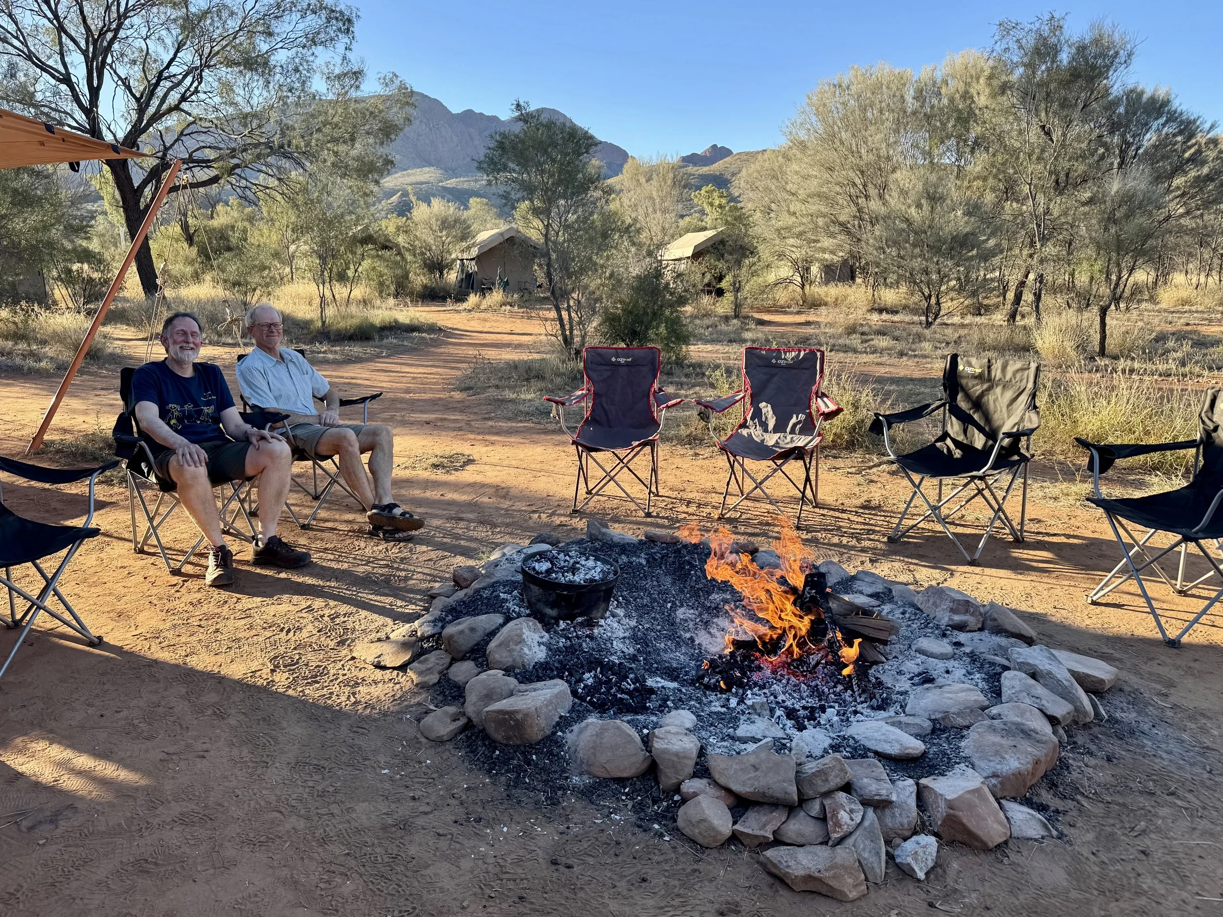
Final camp in the shadow of Mt Sonder