The Walkers Haute Route
Why this walk?
I’m going to answer this indirectly.
The Tour du Mont Blanc (TMB) is one of the world’s great walks. Circumnavigating western Europe’s highest mountain while at the same time ambulating through France, Italy and Switzerland is a mouth watering proposition. Any multi-day walker who gets the chance to do it, shouldn’t think twice.
Many finish the TMB hankering for more alpine walking. And for some there’s also a wish to go a bit higher and challenge themselves a bit more. That’s often how the Haute Route comes onto the radar and that’s how it happened for me.
The Walkers Haute Route is a 215 km route that runs between two storied mountaineering towns, Chamonix and Zermatt. Chamonix lies in the shadow of mighty Mont Blanc, while Zermatt sits beneath the iconic Matterhorn. So the walk links two of Europe’s most famous mountain resorts and two of its best known mountains.
It’s called the Walkers Haute Route to distinguish it from more extreme ventures (ie, the Climbers Haute Route and the Ski-Touring Haute Route).
My path to the Haute Route
Cathy and I walked the Tour du Mont Blanc in 1990 and then again in 2023. In June 2024, after we’d done a variety of alpine and non-alpine walks together, I got the chance to tack on a few extra weeks of walking in Switzerland. I’d been waiting for an opportunity to tackle the Haute Route and here it was.
Mind you, a starting date of 26 June was early in the season. And as the starting date approached, I began hearing that there was still a lot of snow around and that rain was causing track issues (damaged bridges and landslides). In fact, on 21 June, heavy rains caused landslides that resulted in Zermatt being inaccessible by road and rail. Hmmm….my expedition might face some obstacles.
The route of the Haute Route isn’t as fixed as the routes on most other big name multi-day walks. The aim is to follow a course that links 11 passes that range in height from 2,700m to 2,900m. But many expeditions won’t get to all the passes. Poor weather, track conditions (snow, rock falls, high rivers) and track closures often interfere. Adaptability is the name of the game on the HR.
I proposed starting in Trient, 25 km in from the traditional starting point of Chamonix. That 25 km follows the same route as the TMB. Having done the TMB last year, I felt I should save the time.
So, there I was in the Trient walkers hostel on the evening of 25 June. It was thronging with 60 or 70 TMB’ers, excited to be only two days from their finish. Dinner is a school camp type affair; you’re allocated a seat and everyone eats the same fare at the same time.
Given I was walking solo, I was about to introduce myself to my neighbour when a voice with an unmistakable Aussie twang said: “What are the chances of this?” Sitting down opposite me was one of my former law firm partners, Leighton O’Brien! Leighton is a trail runner and, unbelievably, was running the Haute Route. The chances of our schedules and the hostel’s random seating allocations resulting in us sitting across the table from each other must have been infintesimal.
Leighton’s schedule involved completing the route in half the time I’d allocated. No big-noting for me that night!
Day 1 - Trient to Champex
The TMB and the Haute Route both run between Trient and Champex. But the usual route for the Haute Route is over the 2,900m Fenetre D’Arpette, whereas the TMB takes a lower route. I’d chosen to start in Trient specifically to walk over Fenetre D’Arpette.
In the days before arriving in Trient, I’d seen on a couple of hikers’ sites that Fenetre D’Arpette was not passable without specialist equipment. The hostel warden confirmed that, as did Leighton’s run organiser.
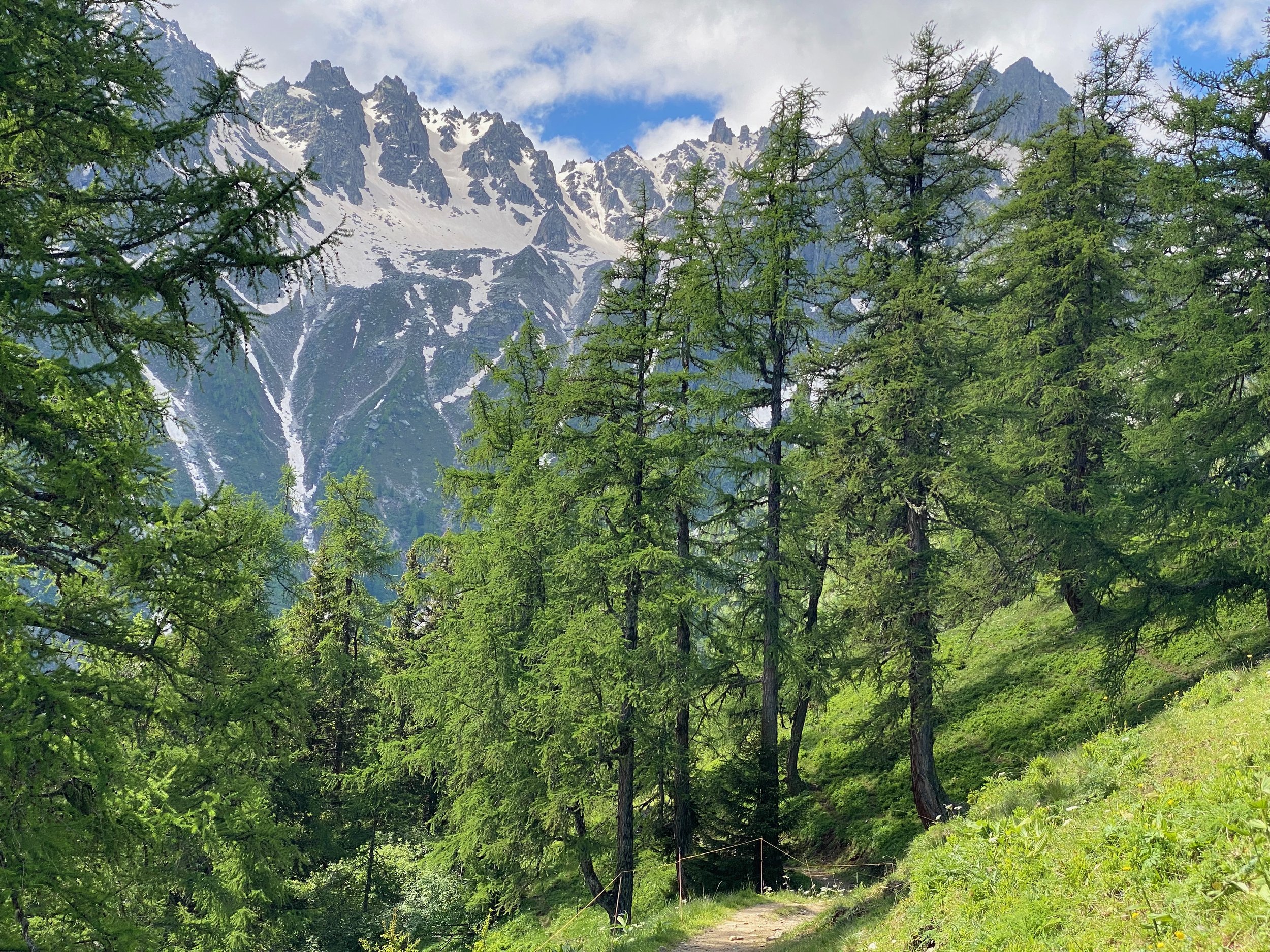
I was disappointed to be foiled at my first Haute Route pass but didn’t dwell on it. Walking’s just a hobby and when safety advice comes from reliable sources, you follow it. Especially when you’re walking solo. In any event, the TMB route, which passes over Forclaz and then Alp Bovine, is not exactly a walk in a parking lot.
Day 2 - Champex to Le Chable
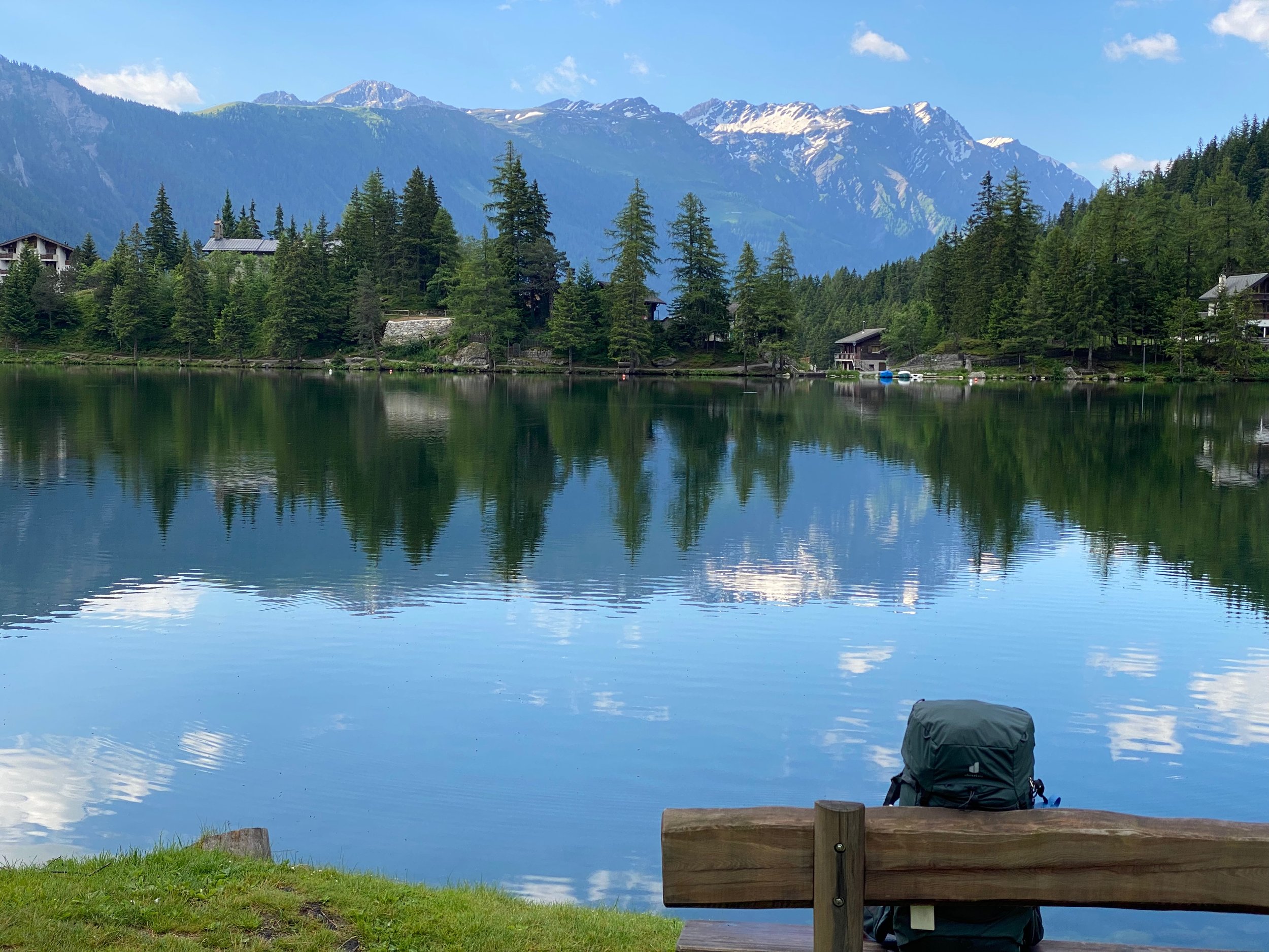
Leaving Champex means leaving one of Europe’s most picturesque mountain lakes. Really, if heaven looked like that, you’d be pretty happy sitting there for eternity.
Leaving Champex also means the end of the overlap with the Tour du Mont Blanc. From greeting walkers every 10 minutes or so, I went to not seeing another walker for the whole day.
Admittedly, there is less to excite walkers on this leg than previous ones. In fact, for a while I wondered whether everyone else had got the bus. I later discovered that most walked the leg; it’s just that there were not a huge number doing the walk at the same time as me.
Le Chable is quite historic but these days it operates primarily as a service centre for Verbier, the upmarket ski resort that sits in a bowl 1,000m above it.
Gondolas whisk you up to Verbier in minutes. As the next day’s route by-passes Verbier, I made use of the gondolas to check out the ski resort. Verbier must be one of the priciest places on the planet to buy anything but I’d been told that the amount of snow on the mountain passes meant I should have hiking boot crampons and Verbier’s outdoor shops stocked them. So, I gritted my teeth and shelled out the exorbitant price.
Day 3 - Le Chable to Cabane du Mont Fort
This leg has 1,660m of ascent and 20m of descent. Can’t say I noticed that 20m of downhill. One of the warmer days I’ve had with the temperature getting to 25C at the lower levels.
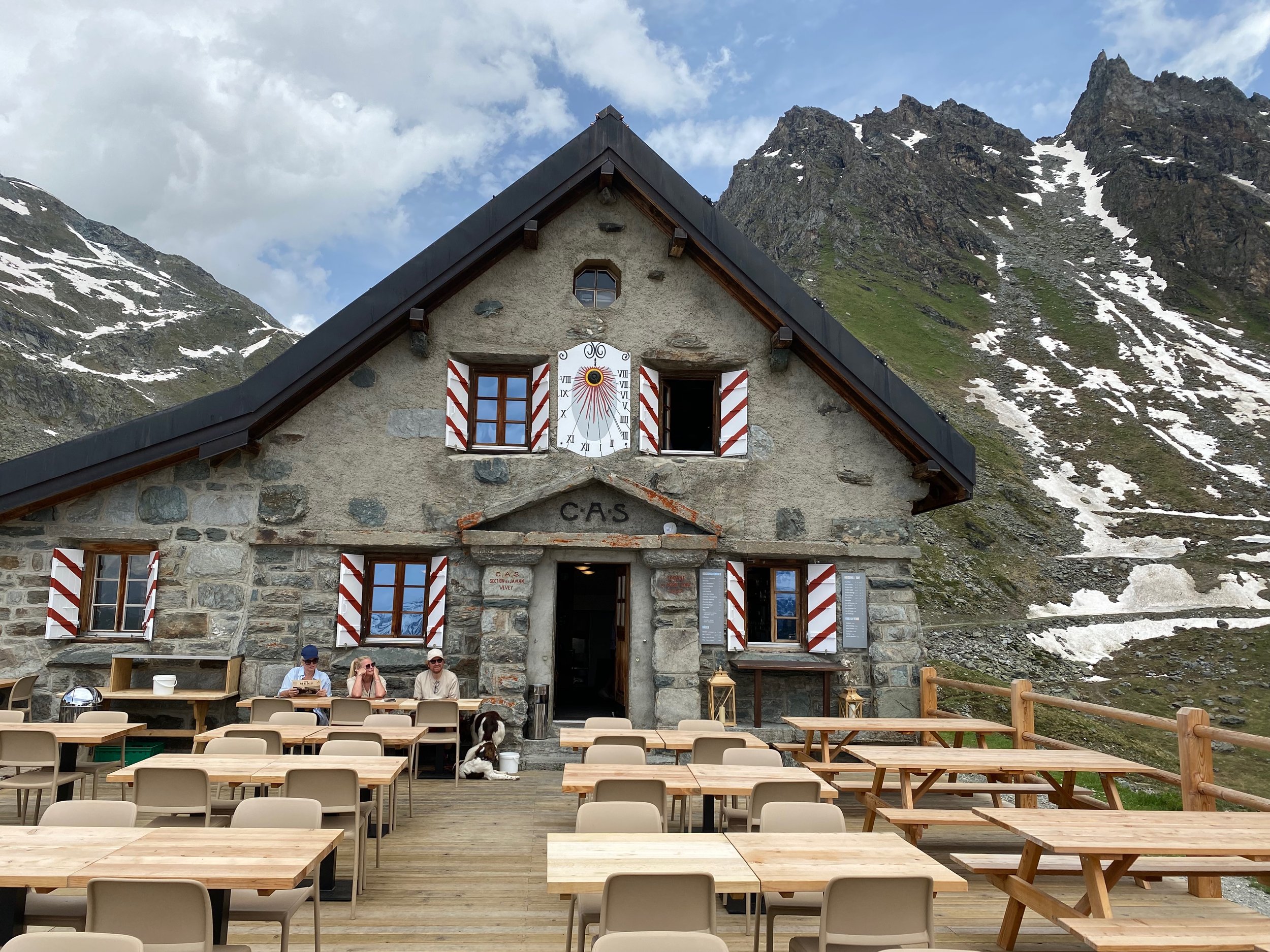
Thankfully, there was shady forest till about 1,800m. But Cabane du Mont Fort is at 2,457m, so after the sanctuary of the forest there was still a couple of hours of sun to contend with before the hut.
My plan was to stay the night at Cabane du Mont Fort. The next day would then be to Cabane de Prafleuri and the day after that to the village of Arolla. However, I knew this plan was shaky.
Reports were that the amount of snow between Mont Fort and Prafleuri had made the route extremely challenging. My trail runner friend Leighton had texted me that he’d turned back after an uncontrolled slide. He’d included some dramatic photos. At Cabane du Mont Fort, the hut wardens strongly recommended against the route. I spoke to a group of pretty hardened walkers in their mid-20s. They also had started and then turned back.
Just like below Fenetre D’Arpette, the decision at Cabane du Mont Fort was pretty easy. I headed for the nearest gondola and dropped back down to Le Chable. On the following day, I would work out a public transport shuffle that would allow me to rejoin the Haute Route on the other side of this drama.
Day 4 - Arolla to Pas de Chevres
Efficient Swiss public transport delivered me around to Arolla in a few hours. I was now ahead of time (and my accommodation bookings). Under my original plan, I would have got to Arolla at the end of Day 5.
I decided to spend the afternoon on an out and back walk to Pas de Chevres. Pas de Chevres is on the Cabane de Prafleuri to Arolla leg and I figured that walking from Arolla to Pas de Chevres would give me a taste of that leg. It would also mean I only missed a day and a half of the Haute Route, rather than two days.
Even in this endeavour I was thwarted. As I got closer to Pas de Chevres, a forecast thunderstorm rolled in with frightening ferocity. With low visibility and plenty of lightning, I turned around and scurried back down the mountain.
Day 5 - Arolla to La Sage
This day presented no passes and the sun gradually emerged. It almost felt like a rest day. The highlight was Lac Bleu, an emerald blue lake set on a plateau. At this time of the year, it’s surrounded by pink alpenrose.
Two-thirds of the way to the lake I came across a sign that the track to the lake was closed. Feeling a bit frustrated after the stumbling blocks of the last few days, I decided to test officialdom’s position on the walkability of the path. The issue was a bridge over a river which was being repaired. The bridge was still eminently useable so I crossed and chalked that as a win for reckless independence in the bush.
The route passes through the attractive village of Les Hauderes. This village is comprised almost uniformly of attractive, old timber houses with colourful flower boxes. Les Hauderes is beautifully positioned at the head of Val d’Herens, with the narrower valleys of Arolla and Ferpecle extending beyond.
But the Haute Route walker doesn’t get to dally in valleys for long. From Les Hauderes, we climb a few hundred metres to the even smaller settlement of La Sage which is a common overnight spot for HR walkers.
Day 6 - La Sage to Cabane de Moiry
This is a day I won’t forget in a hurry. The Haute Route lived up to its name and the snow up high spiced things up even further.
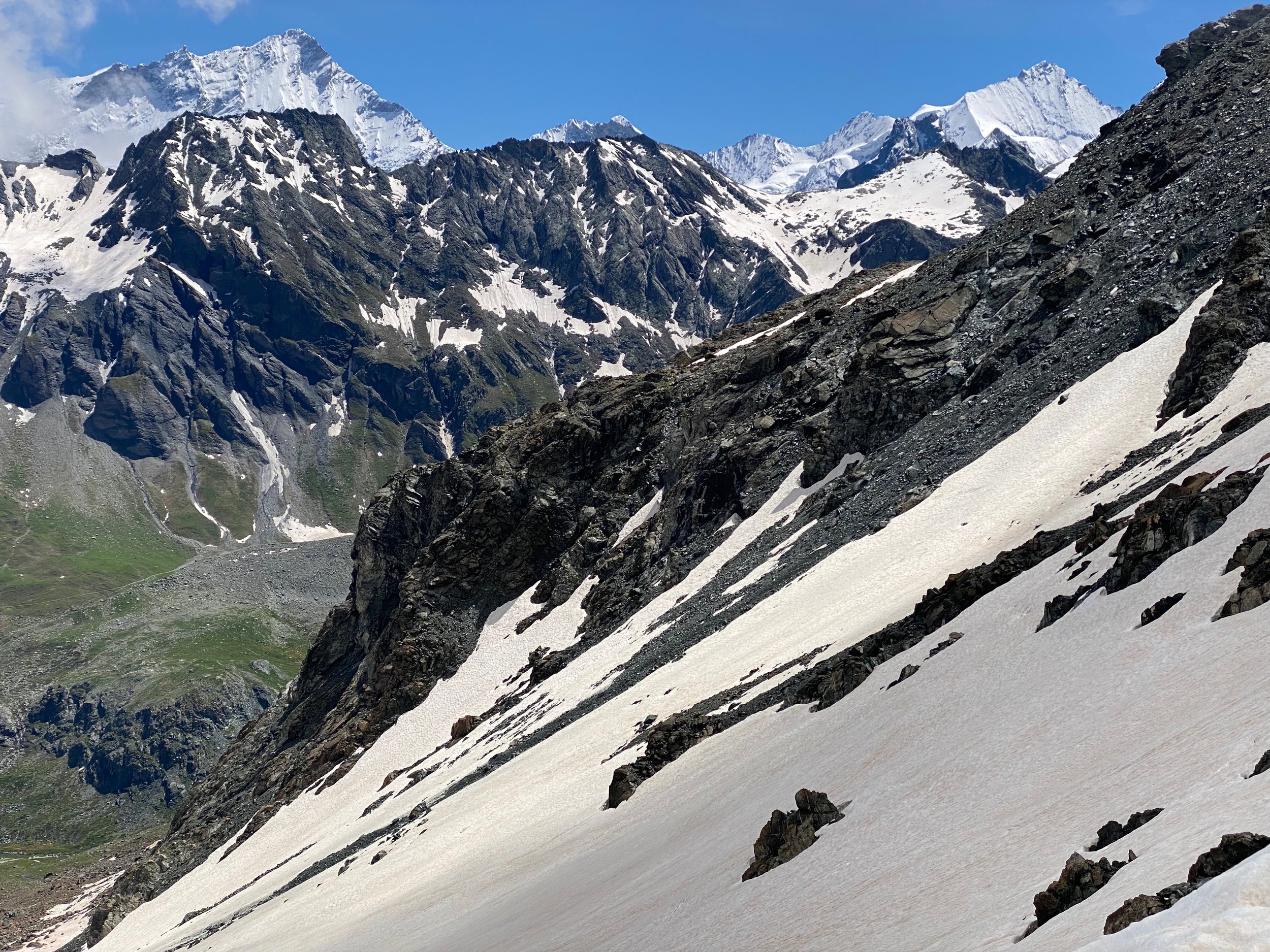
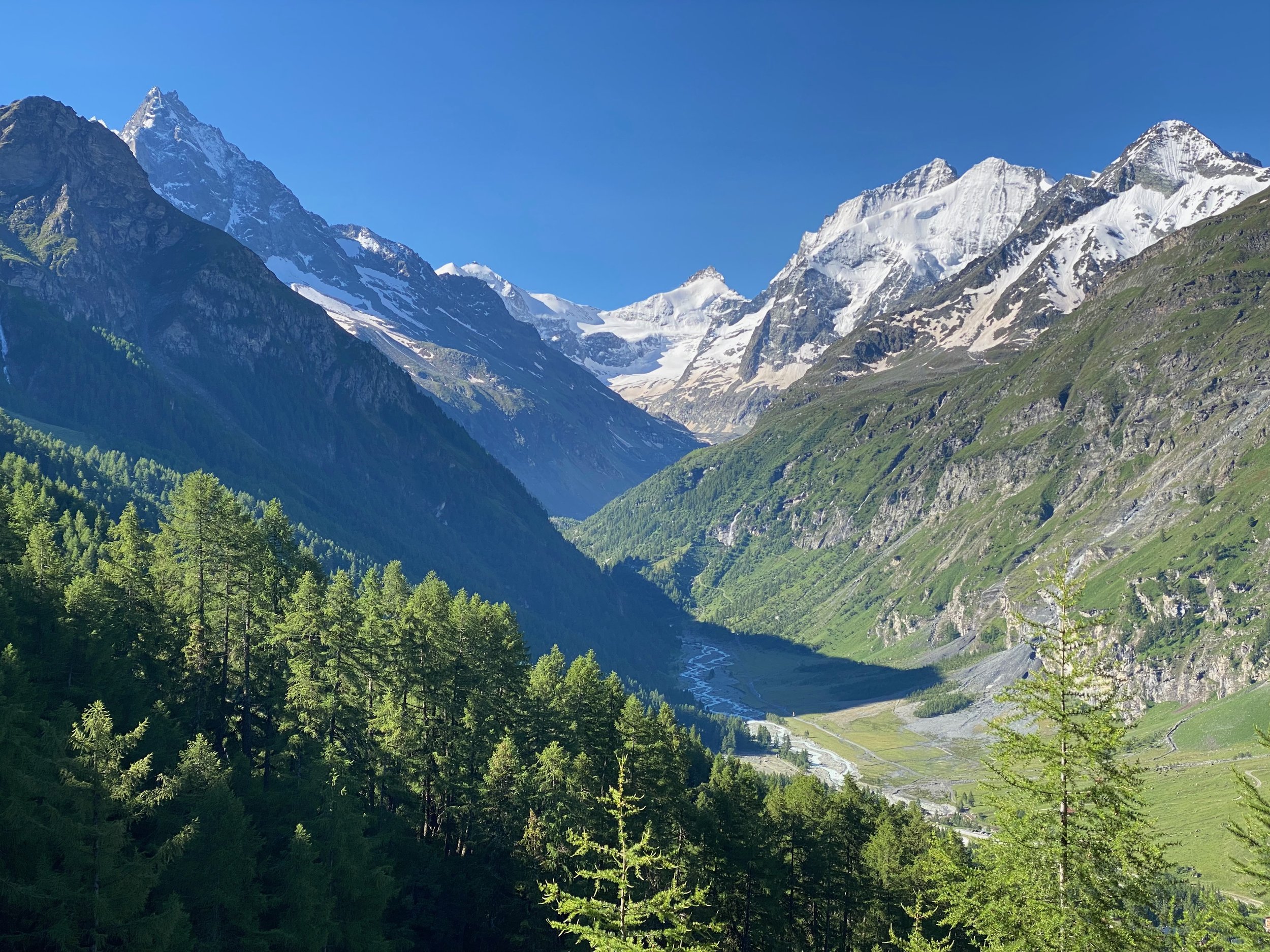
From La Sage (at 1,667m), it’s a steady climb up to Col du Tsate at 2,868m. Larchwoods, moss and waterfalls feature at the lower levels, but gradually it gets too high for the trees and the flowery alpine meadows monopolise. The going becomes progressively rockier until the final push to the pass is through a harsh environment with little vegetation.
I saw virtually no one on the way up and at the col I soaked up the vast rugged alpine vistas in solitude. It was an unusual experience and a stirring one. I felt very lucky to be there.
The way down had more snow than the way up. I expected that as I knew by then that the eastern slopes held more snow than the western slopes. I didn’t use the crampons but some care was required.
Glacier Moiry came into view on the way down. This wall of ice rises from Val de Moiry. It was an impressive sight and it was more than a little daunting to think I had to descend to the floor of Val de Moiry then climb up beside the glacier to get to the night’s accommodation at Cabane de Moiry.
On the way up, the crampons got their first outing! The climb to Cabane de Moiry is quite steep. Tight zig-zags lead through the rocks and shale and, for me, snow. There were footsteps to follow through the snow but the crampons provided far greater security.
Cabane de Moiry (2,825m) is the highest overnight accommodation on most versions of the Haute Route. The cabin’s large kitchen/lounge has an amazing outlook over Glacier Moiry and huge picture windows make the most of the view. Sitting in the lounge, gazing out at the changing moods of the glacier is very special.
Cabane de Moiry is full of earnest mountaineers planning exploits that you couldn’t pay me to join. I listened in, enthralled but very happy in the knowledge that this was as high as I was going and tomorrow I would descend from the stratosphere.
Day 7 - Cabane de Moiry to Zinal
It was about 1C and drizzling at 8.30am when I started the descent from Cabane de Moiry. The crampons were more important on the descent than they had been on the previous afternoon’s ascent. Once out of the snow zone, it’s a joy to be able to stride out without fear of slipping on snow or ice.
The trail then wends its way above the lengthy Lac de Moiry crossing numerous gushing streams. A couple of the bigger streams had swept their bridges away and required some inventiveness and nerve to cross. The alternative was a massive backtrack and detour so there was plenty of incentive to find a way!
The drizzle disappeared but mist swirled up from the lake, creating a moody Scottish feel. The mist provided cover for eagles that circled and swooped.
After a couple of hours on the belvedere trail, it’s time for the next pass - Col de Sorebois and the next valley - Val de Zinal. The climb to Col de Sorebois (2,836m) is steep but relatively short as you haven’t lost too much height on the trail above Val de Moiry.
I shared the col with four guys from The Netherlands who I’d met the night before at Cabane de Moiry. There was a cable-car a few hundred metres below the col that offered a quick and comfortable transfer to the day’s endpoint at Zinal. We debated whether to succumb to the temptation. I felt no hurry to get to Zinal so opted for the walk. For a while I regretted the decision as the path leads through ugly ski-lift infrastructure. But beyond that there’s a dense forest and although the route down is steep it’s very peaceful.
Day 8 - Zinal to Gruben
This stage commences with the usual morning climb out of a valley. However, once the tree-line is reached, rather than tackling the day’s pass immediately, the Haute Route meanders north. I traded leadership responsibilities with the Dutch guys, but apart from them, I didn’t see anyone else on the trail.
It was a bluebird day and I kept turning back (south) to take in the views up Val d’Anniviers to the snow-capped peaks of Pigne de la Le, Grand Cornier and Dent Blanche.
Eventually the track gets serious. It swings eastwards and makes for the pass, known as the Forcletta (2,874m). The climb is civilised with long zig-zags easing the angle of ascent. From the Forcletta, the view forward, to the east, is of a harsh, rocky wilderness. You wouldn’t want to get caught here in bad conditions.
As with the other passes, the snow-cover was more extensive on the eastern side of the pass. I got to the Forcletta just in time to see two of the Dutch guys give up on careful snow plodding and slide down the snow-slope on their backsides. They put 10 minutes on their friends in a few seconds.
The next valley is called the Turtmanntal. It’s a little-known and remote valley only accessed in summer. One small village occupies the valley - Gruben. This is the first German-speaking settlement on the Haute Route.
While small, Gruben boasts the charming Hotel Schwarzhorn. Its outdoor bar/restaurant is idyllic. The evening was mild and for the first time on this walk we were able to eat dinner outside.
Day 9 - Gruben to Gasenried
This day was my favourite. It’s got everything, plus there’s the excitement of at last reaching the final valley - the Mattertal that leads up to the walk’s end at Zermatt.
I left by myself at 8am, having farewelled the Dutch guys at 7am. They were short on time and were attempting to get to Europa Hut that night, with the help of a cable-car and bus. Even with the transport assistance, it’s a very ambitious day.
Again I was lucky to be walking under a clear blue sky in quiet solitude. At the lower levels there were masses of alpenrose, in full bloom and glistening in the morning dew. A bit higher I saw several marmots. Unusually, they seem unfussed by my presence.
Today’s pass is Augstbordpass (2,894m). There’s a lot of snow on the western approach, so I know the eastern descent is going be interesting. The immediate vista from the pass is of a huge rugged, rocky bowl. Above the bowl and in the distance numerous snow-capped mountains fill the horizon.
The descent from Augstbordpass was the trickiest descent of the walk. The snow cover made it difficult to follow the exact trail route. I knew broadly where I was heading but the snow hid the trail and many of the trail markers. At times, the snow provided firm footing, but other times it hid hollows, streams and uneven surfaces.
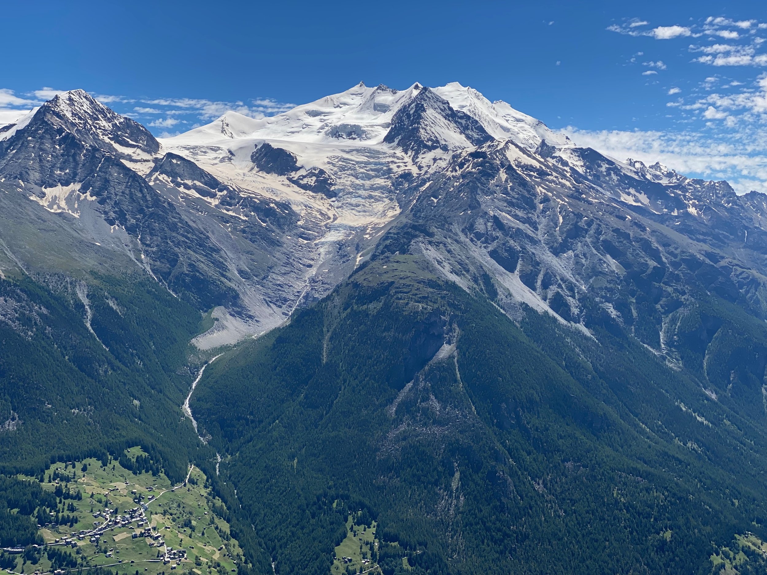
At the far end of the bowl, the snow was left behind and stunning views of the Mattertal opened up. From far above, the valley appears narrow and winding and it’s hard to believe that this is the only passage to the large, vibrant resort of Zermatt.
The end of today’s stage is often St Niklaus down in the valley. However, for those Haute Route walkers who wish to take the high route into Zermatt, it’s worth taking a bus from St Niklaus up to Grachen or Gasenried and spending the night there.
Day 10 - Gasenried to Europa Hut
The high-level track from Gasenried (or nearby Grachen) to Zermatt is called Europaweg. It’s the busiest section of the Haute Route since the early stages where there’s overlap with the Tour du Mont Blanc. Here the busy-ness is because (1) there’s overlap with the Tour de Monte Rosa and (2) it’s a popular stand-alone two day walk.
To be clear, I’m using busy in a relative sense. I went from seeing 5-6 walkers on the trail in a day to 15-20!
The Europaweg route from Gasenried to Europa Hut used to stay high for its entirety. However, that meant it was exposed to rockfalls, so today it takes a different, less extreme route. Basically, the trail wends gently downhill to Herbriggen in the Mattertal valley before climbing the 1,000m back up to Europa Hut. You could just walk along the valley floor from St Niklaus to Herbriggen but to be true to the concept of the Haute Route I’m afraid down and back up is your lot.
Europa Hut is a refuge style hut located at 2,265m, with a fine view from its balcony. The staff are friendly and the interior is smallish but homely. During the season it’s almost always full. Unfortunately, it was raining and misty when I arrived and remained so for my stay.
That night, the UEFA Euro 24 Championship semi-final between Netherlands and Turkey was played. Representatives of both countries strained to view the patchy footage available. The Dutch prevailed, leading to hearty renditions of the Wilhelmus (obscure piece of trivia - apparently it’s the world’s oldest national anthem!).
Day 11 - Europa Hut to Zermatt
The final day of the Haute Route normally involves continuing along the Europaweg all the way to Zermatt. At 23 km, 850m ascent and 1,510m descent, it’s a decent last day!
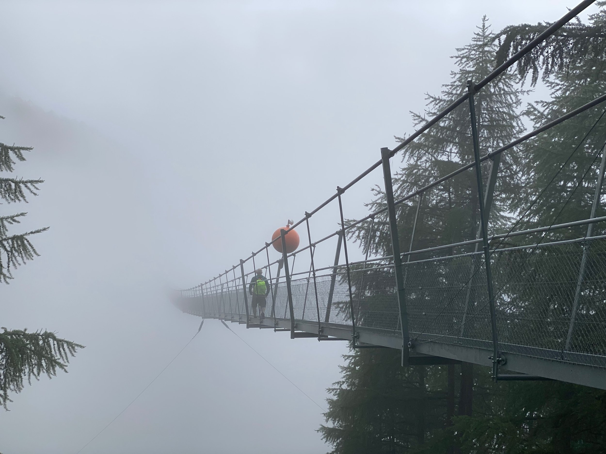
But it’s a wonderful walk as the trail largely stays high above the Mattertal offering balcony views of the valley and the cast of giants that looms above it. It also involves crossing the 500m long Charles Kuonen suspension bridge. This bridge spans a mountain-side notorious for its rockfalls.
Finally, as you approach Zermatt, if you’re lucky with the weather, the Matterhorn looms into sight and stays with you as you descend into Zermatt.
I reached the 500m Charles Kuonen suspension bridge at about 8.30am. It was a misty morning and visibility was down to about 50m. The suspension bridge looked surreal; you could see the first section but then it just disappeared into cloud. As you crossed, you could hear - but not see - stones tumbling down the rock face below.
For me, the Haute Route had one last surprise to spring. At Europa Hut, the wardens told all walkers that an hour or so beyond Europa Hut, the Europaweg was closed and a massive detour down into the valley was in place.
This was very disappointing but down in the valley I discovered that you could get a taxi up to the other side of the closed section of the Europaweg. I was determined not to arrive in Zermatt by following a valley path alongside a road and railway, so paid up for the taxi.
It was absolutely worth it! Clouds cleared away for my final few hours into Zermatt and at the expected time the Matterhorn appeared to accompany me to the finishing line. Mixed emotions arise as you enter Zermatt. The bustle and glamour is exciting but it’s hard not to gaze back up at the mountains wistfully.
PS - In Zermatt, I met up with some fellow Haute Route walkers who had ignored the “Track Closed” signs on the final stage. Not saying that was the right thing, but they got through unscathed.
Craig Henderson
En-route to Champex on Day 1
Lake Champex
Cabane du Mont Fort - Day 3
Col de Tsate - Day 6
Above Zinal - Day 8
Augstbordpass - Day 9
Above St Niklaus - Day 9
Charles Kuonen suspension bridge - Day 11

