Bay of Fires Walk
Highlights:
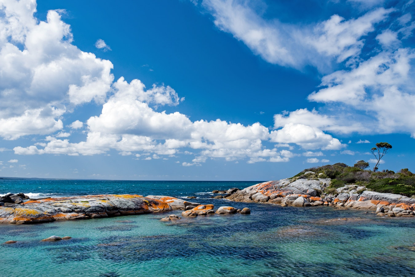
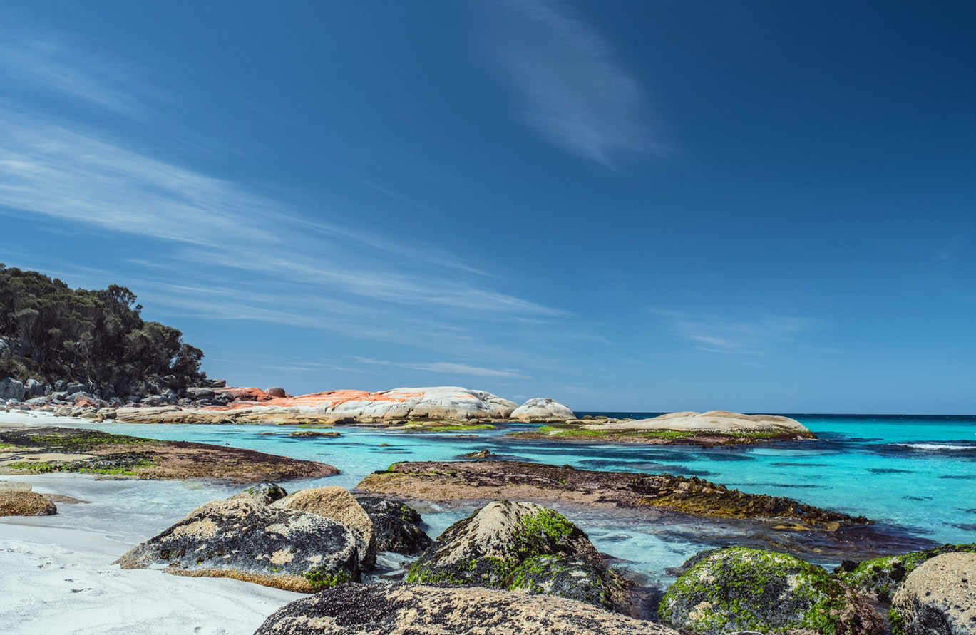
Orange lichen covered rocks
White sand beaches
Turquoise waters
Abundant birdlife/wildlife
Brief:
⏱ Duration: 3 - 4 Days
🗺 Distance: 32 - 56 km
⛰ Grade: Easy to Moderate
🗓 Best Time: Sept - May
🛏 Accomm: Camping or Hotel
Walk Overview
The walks that go under the “Bay of Fires” banner vary hugely in terms of length, level of difficulty and type. The walks are all encompassed within the 70 km stretch of coast lying between the northern end of Mount William National Park (in the north) and Binalong Bay (in the south).
Strictly, the Bay of Fires comprises the southern half of this stretch of coast and some of the walks barely venture into the Bay of Fires itself. But the features are common and it’s such a great moniker that no one’s complaining. It’s like the boundary expansion of an upmarket suburb.
Not many walkers do the entire 70 km stretch of coast, which would typically take about five days. Most of the guided trips do two or three days of walking and then have an “alternative activities” day in the vicinity of Ansons Bay. The guided trips use a variety of different accommodation which (together with the limited number of road access points) dictates the length of each day’s walk.
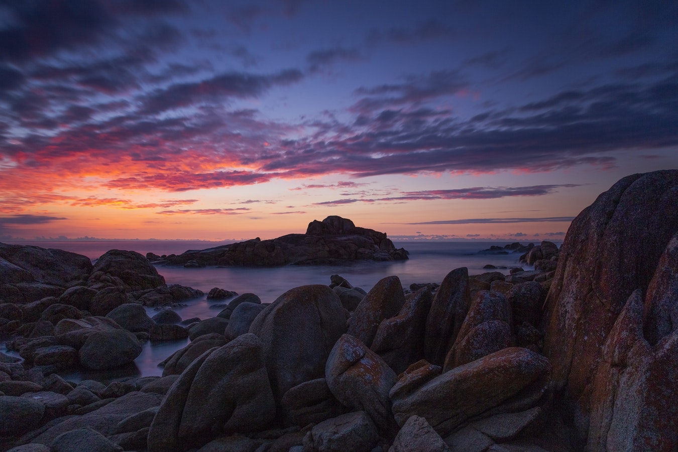
The attractions of all the walks are common - orange lichen covered granite rocks, white sands beaches, turquoise waters and thick coastal vegetation. The beauty and seclusion of this area, as well as its location on Tasmania’s sheltered east coast, is a soothing combination that makes it easy to relax and unwind.
The Bay of Fires was named by Captain Tobias Furneaux in 1773 when he noticed numerous fires along the coast. The fires were the campfires of the local indigenous tribes. It turned out to be an inspired choice as sunlight on the orange lichen boulders - especially at either end of the day - confers a warm tone on the entire coastline.
Further information:
A four day itinerary is described below.
For more information on walking in the Bay of Fires region, click the button below.
Itinerary
An itinerary covering the entire coast is shown below. Most tour operators cover the first two or three days and include a rest day.

Day 1
Stumpys Bay to Deep Creek
Distance: 12km
Time: 5 hours
Accommodation: Camping or Lodge

Day 2
Deep Creek to Policeman’s Point
Distance: 17km
Time: 7 hours
Accommodation: Camping or Lodge

Day 3
Policeman’s Point to Big Lagoon
Distance: 18km
Time: 7.5 hours
Accommodation: Camping or Lodge

Day 4
Big Lagoon to Binalong Bay
Distance: 15km
Time: 6 hours
Accommodation: Camping or Lodge
Walk Options
Guided
Several tour operators offer segments of the Bay of Fires as a guided trip. These trips provide a great deal of flexibility in terms of walking distances.
Generally, the tour operators do Day 1 and a part of Day 2 of the walking itinerary described above.
Accommodation options for these tours include: glamping, comfortable beach house/farm house style accommodation, lighthouse keeper cottages and very comfortable eco-lodge accommodation.
None of the guided operators offer a pack carrying camping trip.
Some tour operators offer additional activities such as boat trips.
Typically, the package offered by these operators includes:
Transfers to and from Launceston
Accommodation
Professional guides
All meals
Transfers between the track and the accommodation
National Park entrance fees
Assisted self-guided
We can also help you book a self-guided walking holiday in the Bay of Fires area. Typically, this will include transfers to and from Launceston, accommodation, all meals, transfers between the track and the accommodation, National Park entrance fees, light daypack walking, detailed maps and trail notes and luggage transfer.
Independent
The stretch of coast between Mount William National Park (in the north) and Binalong Bay (in the south) has a number of campsites with minimal facilities. Their distribution has not been planned to facilitate walking the entire stretch of coast but it is possible to do the entire stretch using the campsites only.
Essential Information
Access
The starting point for the Bay of Fires Walk is on the coast at the northern-most point of Mount William National Park (Stumpys Bay).
There are no public transport facilities directly to the track.
There are private transport operators who can provide transport to and from the track for individuals and groups.
Park entry
The payment of an entry fee is required for all National Parks in Tasmania. Passes may be purchased from the St Helens Visitors Centre.
Best time
The walk can be done year-round. Some people will prefer the warmer months of December to April, particularly if the trip involves camping (or glamping). The walk tour operators tend to operate from October through to May.
Difficulty
This walk is rated at an easy to moderate level of difficulty, depending on how far you choose to walk each day. Ascents and descents are minor.
Accommodation
In addition to the walk accommodation described in ‘Walk Options’ above, there are several accommodation options at either end of the walk. In particular, Binalong Bay and St Helens have some very good accommodation options.
We can assist walkers in choosing the accommodation options which best suit their needs.
Other activities
The Bay of Fires region offers many activities and attractions in addition to its walks. Many walkers choose to add extra days to their trip so that they can further explore the region.
Assistance
We can assist walkers with various aspects of their walking holidays.