Grampians Peaks Trail
Highlights:
Cliffs and escarpments
Unusual geological features
Waterfalls and lush gullies
Indigenous rock art
Brief:
⏱ Duration: 3-13 Days
🗺 Distance: 36-160 km
⛰ Grade: Moderate-Challenging
🗓 Best Time: Sept - June
🛏 Accomm: Camping or various options

Grampians Peaks Trail - Walk Overview
Parks Victoria, the arm of the Victorian Government responsible for overseeing Victoria’s parks and protected natural spaces, has developed “Walk Victoria’s Icons”. Parks Victoria describes the chosen walks as “long distance walking experiences that showcase iconic landscapes”. So far, there are three such iconic walks and the Grampians Peaks Trail is one of them.
While the Grampians has long been one of Victoria’s top walking destinations, and has many excellent walking tracks, the idea of a single trail that traced the entire north - south course of the Grampians was only conceived recently. The chosen route is 160 km long and was officially opened on 12 November, 2021.
Located 260 km (a three hour drive) west of Melbourne, the Grampians are largely housed in the 167,000 hectare Grampians National Park. The Grampians National Park is part of the Gariwerd Aboriginal cultural landscape. The Grampians are listed on Australia's National Heritage List due to their outstanding natural beauty and indigenous rock art sites.
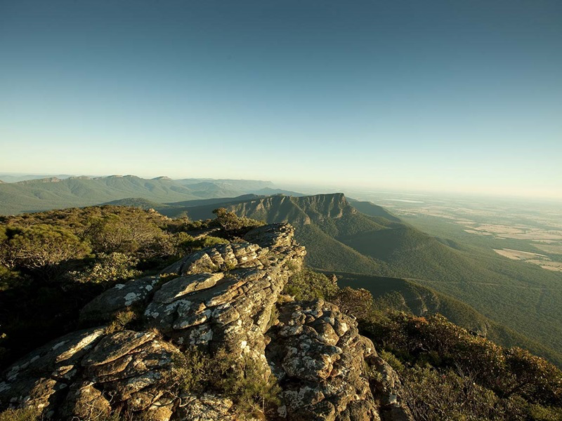
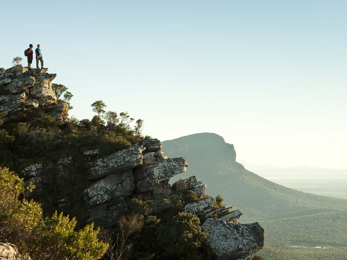
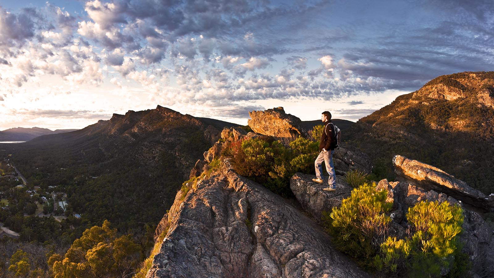
The Grampians comprise massive sandstone mountain ranges that have weathered over millenia to create a spectacular series of elongated cliffs and escarpments, as well as waterfalls, canyons and fern-filled gorges. It is especially well known for its many panoramic lookouts, boulder-strewn terrain, abundant wildlife and colourful spring wildflower displays.
The spectacular Grampians Peaks Trail, in its entirety, is a challenging and long distance Grade 4/Grade 5 hike (most of the trail is classified Grade 4). It takes 13 days to complete and is aimed at experienced fit hikers. The track starts at Mount Zero in the northern section of the national park and finishes at the quaint town of Dunkeld in the south. The track is best experienced in a north to south direction.
There are many hiking highlights along the route including the Gar summit (Mount Difficult), Redman Bluff, Mount William, Major Mitchell Plateau, Signal Peak, Mount Abrupt and Mount Sturgeon. It is important to note that this is a recently completed trail and several aspects, including some campgrounds and water tanks, are still under construction.
Most walkers will probably choose to do shorter sections of the walk at a time. The trail can be divided into the northern, central and southern Grampians.
The central Grampians is a particularly popular section of the park which is easily accessed from the villages of Halls Gap and Wartook. A highlight of the central Grampians is the much-loved Wonderland Ranges which contain iconic natural attractions including The Pinnacle, Venus Baths, Elephant’s Hide, the Grand Canyon, Sundial Peak and Mount Rosea.
Further information:
A three day itinerary based in the central section of the park near Halls Gap is described below (scroll down). This is a 36km loop starting and finishing at Halls Gap.
For more information on walking in the Grampians National Park, click the buttons below.
Grampians Peaks Trail - Itinerary
The walk in the central section of the trail takes 3 days to complete. A sample itinerary is shown below.

Day 1
Halls Gap to Bugiga
Distance: 9km
Time: 5 hours
Accommodation: Camping or various lodgings

Day 2
Bugiga to Borough Huts
Distance: 14km
Time: 5 hours
Accommodation: Camping or various lodgings
Day 3
Borough Huts to Halls Gap
Distance: 14km
Time: 5 hours
Accommodation: Camping or various lodgings
Grampians Peaks Trail - Walk Options
Guided
Several tour operators offer sections of the Grampians Peaks Trail as a guided trip. Most of them also offer four or five day trips that include additional walks in the Grampians.
Accommodation options on the guided walks include eco-friendly huts (in the northern section), comfortable motel or cabin accommodation and luxury lodge accommodation. Some of the tour operators include a first or last night at the award winning Royal Mail Hotel in Dunkeld.
Some tour operators offer additional activities such as wine tastings at local wineries, meals at well-known local eateries and helicopter rides.
Typically, the package offered by these operators include:
Transfers to and from Melbourne
3 or 4 day tour with professional guides
2 or 3 nights accommodation
All meals
Transfers between the track and the accommodation
Assisted self-guided
Some of the tour operators who offer guided trips on the Grampians Peak provide self-guided services as well. Typically, the service includes:
Track notes, maps and information pack
Camping or off-track accommodation
Luggage transport and vehicle transfers between track and accommodation
Breakfasts, dinners and packed lunches
Some level of emergency support
Independent
There are Parks Victoria campsites located at the end of each day’s walk. Campsites need to be booked and paid for before you arrive.
The track campsites have toilets, rainwater tanks, cooking shelters and picnic tables. Walkers must bring their own tents.
There are several tour operators who offer a range of services including transport, camping equipment hire and food provision.
Grampians Peaks Trail - Essential Information
Access
The Grampians Peaks Trail runs from the northern point of the Grampians National Park near Dadswells Bridge to the southern point of the park at Dunkeld. It is located in Western Victoria, which is a three hour (260 km) drive from Melbourne.
The central Grampians is easily accessed from the villages of Halls Gap and Wartook. It’s possible to reach Halls Gap by public transport, but the services are not frequent.
There are private transport operators who can provide transport between Halls Gap and road accessible points of the track. Self-guided and guided tour operators also provide access to the track, as do certain accommodation providers.
There is a walker registration station at Brambuk - the National Park and Cultural Centre in Halls Gap.
Park Entry
An entry pass is not required for the National Park, but campsites must be booked and paid for prior to arrival. This can be done online through the Parks Victoria website or at Brambuk - the National Park and Cultural Centre in Halls Gap.
Best Time
The best time to do the walk is September through to June. The area can get very hot in summer months, but is not invariably so. Therefore, it’s desirable to be flexible in summer and only proceed if conditions are suitable. The same principle applies to bushfire risk. Bushfires can occur during the warmer months, so if forecast conditions suggest a high risk of bushfire consider postponing your trip.
Difficulty
This walk is rated Grade 4/Grade 5 under the Australian Walking Track Grading System, depending upon which section of the trail you choose. This means that tracks may be long, rough and very steep. Directional signage may be limited.
Accommodation
Walkers can access eco-friendly huts in the northern section of the Grampians Peaks Trail at the Gar and Werdug campsites. Access to the huts is only through licensed tour operators who provide a variety of guided tours or support services.
There are also a number of appealing accommodation options scattered throughout the Grampians. Accommodation options range from camping, caravan park cottages and cabins through to luxury lodges and houses. Some of the accommodation providers are attuned to walkers’ needs or offer amenities suited to walkers.
We can assist walkers in choosing and booking with a tour operator which best suits their needs.
Other activities
As well as attracting walkers, the Grampians is popular for rock climbing, mountain bike riding and water-sports. The region is home to a number of well-regarded wineries and hosts a vibrant annual food and wine festival (Grampians Grape Escape - first weekend of May each year).
Grampians Peaks Trail - Route Map
A route map for the central section of the Grampians Peaks Trail is set out below. The marks ‘A’ and ‘B’ indicate the starting point at Halls Gap.
