Goldfields Track
Highlights:
Gold mining relics and shafts
Historic mineral springs spa towns
Lookouts atop the Great Dividing Range
Scenic lakes, rivers, gullies and forests
Brief:
⏱ Duration: 3-10 Days
🗺 Distance: 42-210 km
⛰ Difficulty: Easy-Moderate
🗓 Best Time: All year
🛏 Accomm: Camping,B&B,Motels,Hotels
Goldfields Track - Walk Overview
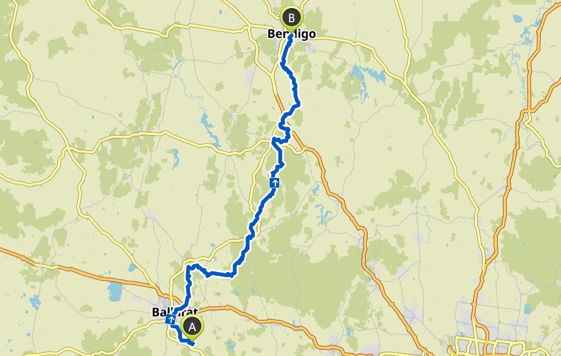
The Goldfields Track is a popular shared use trail for walkers and mountainbikers, covering 210 kilometres between the historic “golden cities” of Ballarat and Bendigo. The trail actually comprises three interlinked tracks - the 90 kilometre Wallaby Track (Mount Buninyong to Daylesford), the 60 kilometre Dry Diggings Track (Daylesford to Castlemaine) and the 60 kilometre Leanganook Track (Castlemaine to Bendigo).
The walk is a wonderful way to explore the varied landscape of Central Victoria and to learn about the region’s gold rush history. It is also a perfect trail for walkers who enjoy a mixture of natural beauty, local heritage sites and vibrant country towns with plenty of creature comforts. In fact, there are so many attractions on offer that rest days and extra days either side of the walk are highly recommended.
As mentioned on the Central Victoria page, the elegant gold rush cities of Ballarat and Bendigo are major drawcards to visitors, each offering a wealth of tourist sites plus excellent accommodation and dining options. The track also passes through smaller heritage towns. Creswick is known for its operating woollen mills and markets whilst Harcourt is home to several wineries. Castlemaine features heritage streetscapes, fine Botanical Gardens, the Old Castlemaine Gaol and the Buda historic home and garden. The track traverses parts of the Castlemaine Natural Heritage Park which features fascinating relics of the gold mining era, set in an open air natural setting.
The pretty towns of Daylesford and Hepburn Springs are well known for their high concentration of mineral springs. Daylesford’s natural attractions include lakes, botanical gardens and forests. Hepburn Springs is also surrounded by shaded woods and river gullies. The Mineral Springs Reserve at Hepburn Springs is a particular highlight as bubbling mineral water can be accessed freely from either continuously flowing streams or hand pumps.
There are many scenic and historic highlights along the way. The southern part of the track features the dense Wombat Forest, the stunning Sailors Falls cascading into a deep gorge and magnificent views of the Mount Franklin volcanic crater. There are numerous gold sluicing and gold diggings sites to explore plus picturesque river gullies and mini canyons. Further north, the track passes the fascinating Coliban Water System which was engineered with gravity fed channels and aqueducts to bring water from the top of the Great Divide to Bendigo. There are also spectacular views afforded atop rocky outcrops overlooking the expansive plains. The panorama from the granite boulders around Mount Alexander is a most memorable vista.
Many people choose to undertake a section of the track at a time. This is relatively easy to organise thanks to regular access points along the trail which enable pick-ups and drop-offs. Located 115 kilometres north-west of Melbourne, the Goldfields Track is easily accessible by car or public transport (train and bus). This undulating track is graded easy to moderate (depending upon which section you are undertaking) and is very well signposted.
Further information:
For more information on doing the Goldfields Track, click the button below. We can help you to plan and book your Goldfields Track adventure (guided or self-guided). We can also assist you with transport, accommodation and travel insurance.
For more information on walking in Central Victoria, click the button below:
Goldfields Track - Route Map
A route map for the Goldfields Track is set out below. The marks ‘A’ and ‘B’ indicate the starting and finishing points. The walk can be undertaken in either direction.


